
IMAGES TAKEN NEAR TO
Springrove, WAREHAM, BH20 7LB
Introduction
This page details the photographs taken nearby to Springrove, BH20 7LB by members of the Geograph project.
The Geograph project started in 2005 with the aim of publishing, organising and preserving representative images for every square kilometre of Great Britain, Ireland and the Isle of Man.

There are currently over 7.5m images from over14,400 individuals and you can help contribute to the project by visiting https://www.geograph.org.uk
Image Map
Images are licensed for reuse under creativecommons.org/licenses/by-sa/2.0
Notes
- Clicking on the map will re-center to the selected point.
- The higher the marker number, the further away the image location is from the centre of the postcode.
Image Listing (125 Images Found)
Images are licensed for reuse under creativecommons.org/licenses/by-sa/2.0
Image
Details
Distance
1
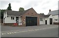
Bere Regis Fire Station
Bere Regis Fire Station, North Street, Bere Regis, Dorset.
Image: © Kevin Hale
Taken: 27 Sep 2006
0.01 miles
2
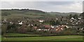
Bere Regis - Woodbury Hill
Bere Regis from Woodbury Hill. Left to right of photo is the Parish Church, then the large white building of Royal Oak Public House.The tall grey tower between the two trees is the training tower at the fire station. Boswell Close is the road leading down from the right.
Image: © Peter Elsdon
Taken: 25 Nov 2009
0.02 miles
3
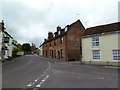
Bere Regis, ghost sign
On West Street; the weathered sign appears to read "BEMISTER/.../CORN AND MEAL/STORES". Now residential.
Image: © Mike Faherty
Taken: 8 Sep 2011
0.08 miles
4
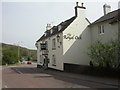
Bere Regis, The Royal Oak
In West Street; during the day time, only the long bar in the previous stable block is open; presumably at meal times the dining room is also open. Pool, darts & patio. Cask ale available at my visit: Fuller's London Pride. For some customer reviews, see http://www.beerintheevening.com/pubs/s/22/22135/Royal_Oak/Bere_Regis
Image: © Mike Faherty
Taken: 23 Apr 2009
0.09 miles
5
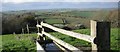
Bere Regis - Woodbury Hill
Looking west from the water trough towards the white building of the Bere Regis sports Club. Townsend Business park is to the right. The cutting running from the trees to the right, towards the centre of the picture guides the A35 to Dorchester and beyond.
Image: © Peter Elsdon
Taken: 25 Nov 2009
0.12 miles
7
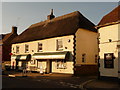
Bere Regis: village stores and post office
These two outlets are separate premises, rather than the common setup of having the post office in the back of the village shop.
Image: © Chris Downer
Taken: 12 Sep 2009
0.12 miles
8
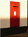
Bere Regis: postbox № BH20 194, West Street
This Elizabeth II-reigb postbox is set into the wall of the post office (see Image) and is emptied finally at 4:45pm on weekdays and at 10:15am on Saturdays.
Image: © Chris Downer
Taken: 12 Sep 2009
0.13 miles
9
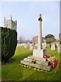
Bere Regis, war memorial
In Image; commemorating twenty-eight fallen in WWI and four in WWII.
Image: © Mike Faherty
Taken: 10 Apr 2013
0.13 miles
10
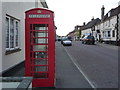
Bere Regis: red phone box in the High Street
One of two traditional K6 phone boxes in Bere Regis - the other is Image
Image: © Chris Downer
Taken: 25 May 2013
0.13 miles