
IMAGES TAKEN NEAR TO
East Morden, WAREHAM, BH20 7EP
Introduction
This page details the photographs taken nearby to BH20 7EP by members of the Geograph project.
The Geograph project started in 2005 with the aim of publishing, organising and preserving representative images for every square kilometre of Great Britain, Ireland and the Isle of Man.

There are currently over 7.5m images from over14,400 individuals and you can help contribute to the project by visiting https://www.geograph.org.uk
Image Map
Images are licensed for reuse under creativecommons.org/licenses/by-sa/2.0
Notes
- Clicking on the map will re-center to the selected point.
- The higher the marker number, the further away the image location is from the centre of the postcode.
Image Listing (14 Images Found)
Images are licensed for reuse under creativecommons.org/licenses/by-sa/2.0
Image
Details
Distance
1
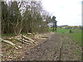
Morden, timber
Coppiced hazelwood awaiting removal.
Image: © Mike Faherty
Taken: 10 Apr 2014
0.18 miles
2
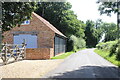
Lower Street, East Morden
Looking south towards Fire Station Corner, the junction with Quarr Lane.
Image: © Nigel Mykura
Taken: 17 Jul 2021
0.19 miles
3
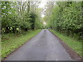
Morden, farm road
Sturdy farm entrance with ramps, and right of way, from Brooks Farm to B3075.
Image: © Mike Faherty
Taken: 13 May 2010
0.21 miles
4
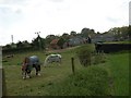
Morden, Sellers Farm
In the centre of the scattered village, as seen from neighbouring footpath.
Image: © Mike Faherty
Taken: 13 May 2010
0.23 miles
5
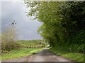
Morden, Goodwin's Lane
Lane from Morden to Cockett Hill.
Image: © Mike Faherty
Taken: 13 May 2010
0.23 miles
6
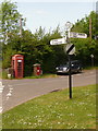
Morden: old-fashioned finger post
This finger post retains its original Dorset finial, giving location and grid reference details. The location, 'Cock & Bottle', refers to the pub diagonally opposite on the left.
The grid reference appears to be wrong, however – for a close-up see Image – the first three digits, 913, are correct but the wrong three digits have been selected for the second half. Given as 094, it should say 946.
See also Image
For a close-up of the finial, see Image
Image: © Chris Downer
Taken: 24 May 2009
0.23 miles
7
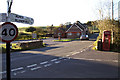
The Cock and Bottle Inn, Morden, Dorset
'Cock & Bottle' was once quite a common name for public houses and is believed to refer to the availability of liquor in draught or bottled form, the 'cock' being the name for the tap in the front of a barrel. The telephone box really does lean at an angle!
Image: © John Lamper
Taken: 17 Nov 2005
0.24 miles
8
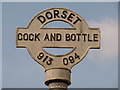
Morden: detail of Cock & Bottle finger-post
A close-up of the finial of the finger-post (see Image), giving location and grid reference details.
It will be noted that the grid reference SY 913 946 is written in full, without the SY prefix, as 3913 0946. Therefore, while the correct three digits have been used for the easting, the northing should read 946 and not 094 as given on the sign.
Image: © Chris Downer
Taken: 13 Mar 2010
0.24 miles
9
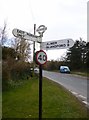
Direction Sign - Signpost by the B3075, Quarr Hill
Annulus and bar finial - 3 arms; Dorset halo with NGR by the UC road, in parish of Morden (Purbeck District), Cock and Bottle, junction with UC road to East Morden, on verge.
Surveyed
Milestone Society National ID: DO_SY9194
Image: © Milestone Society
Taken: Unknown
0.24 miles
10
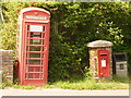
Morden: postbox № BH20 102 and phone, Lower Street
The George VI-reign postbox is emptied finally at 5pm on weekdays and at noon on Saturdays.
Image: © Chris Downer
Taken: 24 May 2009
0.24 miles