
IMAGES TAKEN NEAR TO
West Morden, WAREHAM, BH20 7EA
Introduction
This page details the photographs taken nearby to BH20 7EA by members of the Geograph project.
The Geograph project started in 2005 with the aim of publishing, organising and preserving representative images for every square kilometre of Great Britain, Ireland and the Isle of Man.

There are currently over 7.5m images from over14,400 individuals and you can help contribute to the project by visiting https://www.geograph.org.uk
Image Map
Images are licensed for reuse under creativecommons.org/licenses/by-sa/2.0
Notes
- Clicking on the map will re-center to the selected point.
- The higher the marker number, the further away the image location is from the centre of the postcode.
Image Listing (6 Images Found)
Images are licensed for reuse under creativecommons.org/licenses/by-sa/2.0
Image
Details
Distance
1
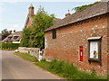
Morden: postbox № BH20 110, West Morden
This Victorian postbox, set into a wall of Kings Corner Farm, is emptied at 4:55pm on weekdays and at 8:45am on Saturdays. Alongside is a parish noticeboard.
Image: © Chris Downer
Taken: 24 May 2009
0.04 miles

4

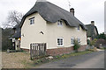
West Morden Farm
An impressive L-shaped Georgian farmhouse. The 1871 census indicates that "James LITHGOW, ... farmer of 630 acres" employed "13 men 17 boys".
Image: © Derek Harper
Taken: 28 Sep 2007
0.18 miles
5

Track next to West Morden Farm
Image: © Lorraine and Keith Bowdler
Taken: 28 May 2010
0.22 miles
6
Morden, public route
From West Morden Farm to the main highway.
Image: © Mike Faherty
Taken: 5 May 2017
0.24 miles