
IMAGES TAKEN NEAR TO
Baker Close, WAREHAM, BH20 6HD
Introduction
This page details the photographs taken nearby to Baker Close, BH20 6HD by members of the Geograph project.
The Geograph project started in 2005 with the aim of publishing, organising and preserving representative images for every square kilometre of Great Britain, Ireland and the Isle of Man.

There are currently over 7.5m images from over14,400 individuals and you can help contribute to the project by visiting https://www.geograph.org.uk
Image Map
Images are licensed for reuse under creativecommons.org/licenses/by-sa/2.0
Notes
- Clicking on the map will re-center to the selected point.
- The higher the marker number, the further away the image location is from the centre of the postcode.
Image Listing (11 Images Found)
Images are licensed for reuse under creativecommons.org/licenses/by-sa/2.0
Image
Details
Distance
1
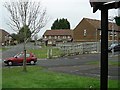
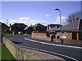
Burton Wood, Wool
Raglan Housing Assn. estate
Image: © Mike Farley
Taken: 18 Feb 2005
0.11 miles
2
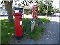
Wool: postbox № BH20 146 and phone, Dorchester Road
This postbox and phone box stand on the grass triangle at the junction where Collier's Lane comes out on the main road. The postbox is emptied finally at 5pm on weekdays and at 9:15am on Saturdays.
Image: © Chris Downer
Taken: 25 Jul 2009
0.16 miles
4
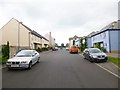
Braytown, The Briars
Modern housing development off Dorchester Road. The builders seem to have tried hard to vary shapes and finishes.
Image: © Mike Faherty
Taken: 23 Aug 2014
0.23 miles
5
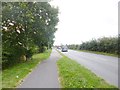
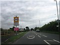
Wool, Dorchester Road
A352, from Dorchester to Wareham.
Image: © Mike Faherty
Taken: 23 Aug 2014
0.23 miles
6
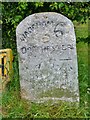
Old Milestone by the A352, Wool
Carved stone post by the A352, in parish of Wool (Purbeck District), 150m East of roundabout, 5m back from road behind verge and tarmac footpath, by hedge, on North side of road. Dorset 3 (limestone), erected by the Dorchester & Wool Turnpike Trust in the 19th century. Photo from 2025 https://www.facebook.com/groups/148269922014080/permalink/2889167271257651/?app=fbl
Inscription reads:-
WAREHAM 6
DORCHESTER
11
Carved benchmark on right hand side of front face at same level as '11'.
Milestone Society National ID: DO_DOWA11.
Image: © Milestone Society
Taken: 16 May 2017
0.23 miles
7
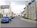
Braytown, The Poppies
Modern housing development off Dorchester Road. The builders seem to have tried hard to offer differing materials and finishes to houses.
Image: © Mike Faherty
Taken: 23 Aug 2014
0.23 miles
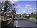
10
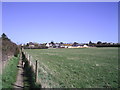
Bailey's Drove from Giddy Green footpath
View along the footpath to Wool from Giddy Green, showing the backs of houses in Bailey's Drove
Image: © Mike Farley
Taken: 8 Apr 2006
0.24 miles