
IMAGES TAKEN NEAR TO
Knowlewood Knap, WAREHAM, BH20 6ED
Introduction
This page details the photographs taken nearby to Knowlewood Knap, BH20 6ED by members of the Geograph project.
The Geograph project started in 2005 with the aim of publishing, organising and preserving representative images for every square kilometre of Great Britain, Ireland and the Isle of Man.

There are currently over 7.5m images from over14,400 individuals and you can help contribute to the project by visiting https://www.geograph.org.uk
Image Map
Images are licensed for reuse under creativecommons.org/licenses/by-sa/2.0
Notes
- Clicking on the map will re-center to the selected point.
- The higher the marker number, the further away the image location is from the centre of the postcode.
Image Listing (20 Images Found)
Images are licensed for reuse under creativecommons.org/licenses/by-sa/2.0
Image
Details
Distance
1
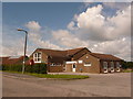
Wool: postbox № BH20 275 and library, Collier?s Lane
This postbox stands outside the library and community centre, and receives its final collection at 5pm on weekdays and 9:15am on Saturdays.
Image: © Chris Downer
Taken: 25 Jul 2009
0.06 miles
2

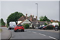
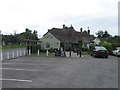
Wool Royal British Legion
On Colliers Lane.
Image: © Mike Faherty
Taken: 28 Mar 2013
0.15 miles

4
![Wool Buildings [1]](https://s3.geograph.org.uk/geophotos/07/25/80/7258063_3d71e82c_120x120.jpg)
Wool Buildings [1]
The Roman Catholic church of St Joseph, The Square, was built between 1969 and 1971. Constructed with a space-frame roof of aluminium and of exposed brickwork, a mineral render and vertical glazing. Listed, grade II*, with details at: https://historicengland.org.uk/listing/the-list/list-entry/1416504
Wool is a large village in Dorset, midway between Dorchester and Poole, both about 10 miles distant. Set on the south bank of the River Frome, the village includes Bovington Camp army base to the north. The place-name 'Wool' is first recorded in Anglo-Saxon Writs in the first years of the 11th century. The ruins of Bindon Abbey are nearby, demolished in 1539, the stone was used to build castles in Portland, Lulworth and Sandsfoot.
Image: © Michael Dibb
Taken: 31 May 2022
0.17 miles
7
![Wool features [8]](https://s1.geograph.org.uk/geophotos/07/25/95/7259581_1f861aaa_120x120.jpg)
Wool features [8]
The annual scarecrow competition was being held in the village. This entry is in Duck Street.
Wool is a large village in Dorset, midway between Dorchester and Poole, both about 10 miles distant. Set on the south bank of the River Frome, the village includes Bovington Camp army base to the north. The place-name 'Wool' is first recorded in Anglo-Saxon Writs in the first years of the 11th century. The ruins of Bindon Abbey are nearby, demolished in 1539, the stone was used to build castles in Portland, Lulworth and Sandsfoot.
Image: © Michael Dibb
Taken: 31 May 2022
0.20 miles
8
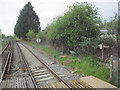
Looking west along railway at Wool level crossing
Image: © John Firth
Taken: 12 May 2010
0.21 miles
9
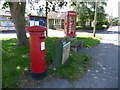
Wool: postbox № BH20 146 and phone, Dorchester Road
This postbox and phone box stand on the grass triangle at the junction where Collier's Lane comes out on the main road. The postbox is emptied finally at 5pm on weekdays and at 9:15am on Saturdays.
Image: © Chris Downer
Taken: 25 Jul 2009
0.21 miles
10
![Wool houses [27]](https://s2.geograph.org.uk/geophotos/07/25/95/7259578_34609431_120x120.jpg)
Wool houses [27]
Ivy Cottage, nearer the camera, and Sturmey Cottage, in Duck Street, are a pair of late 18th century semi-detached cottages. Constructed of plastered cob walls on a stone base under a thatch roof. Some original internal features remain. Listed, grade II, with details at: https://historicengland.org.uk/listing/the-list/list-entry/1304558
Wool is a large village in Dorset, midway between Dorchester and Poole, both about 10 miles distant. Set on the south bank of the River Frome, the village includes Bovington Camp army base to the north. The place-name 'Wool' is first recorded in Anglo-Saxon Writs in the first years of the 11th century. The ruins of Bindon Abbey are nearby, demolished in 1539, the stone was used to build castles in Portland, Lulworth and Sandsfoot.
Image: © Michael Dibb
Taken: 31 May 2022
0.22 miles