
IMAGES TAKEN NEAR TO
High Street, WAREHAM, BH20 6BP
Introduction
This page details the photographs taken nearby to High Street, BH20 6BP by members of the Geograph project.
The Geograph project started in 2005 with the aim of publishing, organising and preserving representative images for every square kilometre of Great Britain, Ireland and the Isle of Man.

There are currently over 7.5m images from over14,400 individuals and you can help contribute to the project by visiting https://www.geograph.org.uk
Image Map
Images are licensed for reuse under creativecommons.org/licenses/by-sa/2.0
Notes
- Clicking on the map will re-center to the selected point.
- The higher the marker number, the further away the image location is from the centre of the postcode.
Image Listing (190 Images Found)
Images are licensed for reuse under creativecommons.org/licenses/by-sa/2.0
Image
Details
Distance
1
![Wool houses [3]](https://s0.geograph.org.uk/geophotos/07/25/80/7258072_4e8c84e6_120x120.jpg)
Wool houses [3]
Tumbledown Cottage, number 8 High Street, was probably built in the 18th century. Constructed of plastered rubble stone under a thatch roof. There is a large outbuilding at the rear. Listed, grade II, with details at: https://historicengland.org.uk/listing/the-list/list-entry/1152923
Wool is a large village in Dorset, midway between Dorchester and Poole, both about 10 miles distant. Set on the south bank of the River Frome, the village includes Bovington Camp army base to the north. The place-name 'Wool' is first recorded in Anglo-Saxon Writs in the first years of the 11th century. The ruins of Bindon Abbey are nearby, demolished in 1539, the stone was used to build castles in Portland, Lulworth and Sandsfoot.
Image: © Michael Dibb
Taken: 31 May 2022
0.01 miles
2
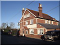
Black Bear, Wool
Friendly pub on Wool's High Street serving good food and ale.
Image: © Colin Smith
Taken: 16 Jan 2012
0.01 miles
3
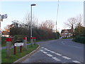
High St Wool
This is looking south down High St from its northern end where it meets Bindon Lane. In the background can be seen the Black Bear Pub. On the left the sign post indicates the direction to the A352 leading west to Dorchester and Weymouth or east to Wareham.
Image: © Nigel Mykura
Taken: 2 Feb 2013
0.02 miles
4
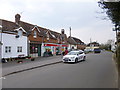
Wool Post Office
Post office and Spar store on High Street.
Image: © Mike Faherty
Taken: 28 Mar 2013
0.02 miles
5
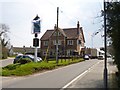
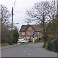
Wool, The Black Bear
Hall & Woodhouse pub on High Street, at the corner of Spring Street. Internally, central bar, with dining room back, and drinking/eating front; garden.
Cask ales on offer at my visit: Badger, Firkin Fox. For some customer comments, see http://www.beerintheevening.com/pubs/s/60/6029/Black_Bear/Wool
Image: © Mike Faherty
Taken: 28 Mar 2013
0.02 miles
7
![Wool houses [8]](https://s1.geograph.org.uk/geophotos/07/25/81/7258101_6a538cef_120x120.jpg)
Wool houses [8]
Part of a terrace, peppercorn Cottage, number 44 Spring Street, was probably built in the 18th century. Constructed of brick under a thatch roof. There is a modern rear wing. There are three horizontally sliding sash windows. Some original internal features remain. Listed, grade II, with details at: https://historicengland.org.uk/listing/the-list/list-entry/1152946
Wool is a large village in Dorset, midway between Dorchester and Poole, both about 10 miles distant. Set on the south bank of the River Frome, the village includes Bovington Camp army base to the north. The place-name 'Wool' is first recorded in Anglo-Saxon Writs in the first years of the 11th century. The ruins of Bindon Abbey are nearby, demolished in 1539, the stone was used to build castles in Portland, Lulworth and Sandsfoot.
Image: © Michael Dibb
Taken: 31 May 2022
0.03 miles
8
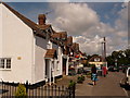
Wool: the post office and neighbours
One of Wool's convenience stores houses the village post office, among attractive frontages on the High Street.
Wool's post office was established on 4 October 1843, becoming a money order & savings bank on 1 November 1884 and a telegraph office on 1 August 1888.
Image: © Chris Downer
Taken: 25 Jul 2009
0.03 miles
9
![Wool houses [11]](https://s2.geograph.org.uk/geophotos/07/25/81/7258178_f642cd34_120x120.jpg)
Wool houses [11]
This terraced cottage, The Old Bakehouse, number 47 Spring Street, was probably built in the 18th century. Constructed of rubble stone with brick dressings under a tile roof. The windows are horizontally sliding sash. The former bakery was a wing at the rear. Listed, grade II, with details at: https://historicengland.org.uk/listing/the-list/list-entry/1304509
Wool is a large village in Dorset, midway between Dorchester and Poole, both about 10 miles distant. Set on the south bank of the River Frome, the village includes Bovington Camp army base to the north. The place-name 'Wool' is first recorded in Anglo-Saxon Writs in the first years of the 11th century. The ruins of Bindon Abbey are nearby, demolished in 1539, the stone was used to build castles in Portland, Lulworth and Sandsfoot.
Image: © Michael Dibb
Taken: 31 May 2022
0.03 miles
10
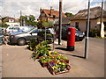
Wool: postbox № BH20 81, High Street
This postbox stands outside the post office (see Image) and is emptied finally at 5:15pm on weekdays and at 10:30am on Saturdays.
Image: © Chris Downer
Taken: 25 Jul 2009
0.03 miles