
IMAGES TAKEN NEAR TO
Steeple, WAREHAM, BH20 5PB
Introduction
This page details the photographs taken nearby to BH20 5PB by members of the Geograph project.
The Geograph project started in 2005 with the aim of publishing, organising and preserving representative images for every square kilometre of Great Britain, Ireland and the Isle of Man.

There are currently over 7.5m images from over14,400 individuals and you can help contribute to the project by visiting https://www.geograph.org.uk
Image Map
Images are licensed for reuse under creativecommons.org/licenses/by-sa/2.0
Notes
- Clicking on the map will re-center to the selected point.
- The higher the marker number, the further away the image location is from the centre of the postcode.
Image Listing (11 Images Found)
Images are licensed for reuse under creativecommons.org/licenses/by-sa/2.0
Image
Details
Distance
2
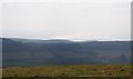
View towards Kimmeridge from Ridgeway Hill
A silhouette of the coast line at Kimmeridge, Clavell Tower can just be seen to the centre right and is visible for miles around. Kimmeridge Bay in Dorset is part of the only stretch of our coastline so far awarded World Heritage Site designation.
Image: © Peter Elsdon
Taken: 13 Mar 2010
0.10 miles

4
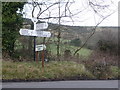
Steeple: finger-post at Blackmanston
The 'fingers' on this sign are modern replacements and would originally have had semicircular ends. It does, however, retain its original Dorset finial, with the location, Blackmanston, written through the middle and six-figure grid reference below.
Image: © Chris Downer
Taken: 17 Jan 2009
0.22 miles
5
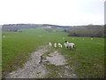
Steeple, sheep grazing
On the slopes of Purbeck Hills.
Image: © Mike Faherty
Taken: 28 Mar 2013
0.22 miles
6
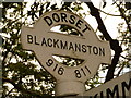
Steeple: detail of Blackmanston finger-post
A close-up of the finial of the finger-post (see Image), giving location and grid reference details.
Image: © Chris Downer
Taken: 19 Jun 2010
0.22 miles
7
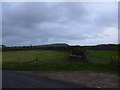
Farmland opposite St Michael & All Angels, Steeple
Image: © Basher Eyre
Taken: 11 Dec 2014
0.24 miles
8
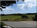
Farmland opposite Cheech Church
Compare with this winter view taken some years ago https://www.geograph.org.uk/photo/4287188
Image: © Basher Eyre
Taken: 27 Jul 2019
0.24 miles
9
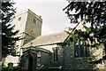
Where the Stars and Stripes originated
The Lawrence family, who had connections with Steeple and whose coat of arms appears in the church, had ancestors related to those of George Washington, and it is said that the stars and stripes of the Lawrence coat of arms inspired the formation of the US flag.
Image: © Chris Downer
Taken: Unknown
0.24 miles
10
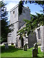
The Church of St Michael and All Angels, Steeple, Dorset
This small and remote church with Twelfth Century origins was enlarged and altered in the sixteenth, seventeenth and nineteenth. In the North transept is located an old barrel organ. It was bought in 1858 by the then rector, the Reverend Nathaniel Bond, for 100 guineas. The organ has three barrels each containing twelve tunes It was placed in a gallery at the West end of the church where it was in regular use until 1890. In 1990 the decision was made to restore it, and with its new metal and wooden pipes in place a ceremony of rededication took place in September 1994.
Image: © Derek Voller
Taken: 9 Jul 2011
0.25 miles