IMAGES TAKEN NEAR TO
West Street, WAREHAM, BH20 5HD
Introduction
This page details the photographs taken nearby to West Street, BH20 5HD by members of the Geograph project.
The Geograph project started in 2005 with the aim of publishing, organising and preserving representative images for every square kilometre of Great Britain, Ireland and the Isle of Man.

There are currently over 7.5m images from over14,400 individuals and you can help contribute to the project by visiting https://www.geograph.org.uk
Image Map
Images are licensed for reuse under creativecommons.org/licenses/by-sa/2.0
Notes
- Clicking on the map will re-center to the selected point.
- The higher the marker number, the further away the image location is from the centre of the postcode.
Image Listing (1302 Images Found)
Images are licensed for reuse under creativecommons.org/licenses/by-sa/2.0
Image
Details
Distance
1
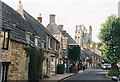
Corfe Castle: West Street
A classic view of this tourist magnet, combining picturesque villagey buildings with the famous castle.
Image: © Chris Downer
Taken: Unknown
0.00 miles
2
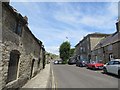
West Street
West Street Corfe Castle looking towards the church
Image: © Bill Nicholls
Taken: 18 Jul 2015
0.00 miles
4
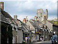
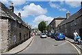
Old cottages West Street - Corfe Castle
The wavy stone roof tiles and gable windows give these buildings much character against the dramatic background of the castle ruins.
Image: © Sarah Smith
Taken: 20 Sep 2009
0.00 miles
5
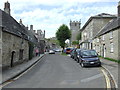
West Street, Corfe Castle
West Street in the Dorset village of Corfe Castle.
Image: © Malc McDonald
Taken: 17 Aug 2012
0.00 miles
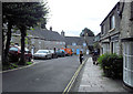
7
![Corfe Castle houses [14]](https://s3.geograph.org.uk/geophotos/06/79/36/6793615_ffef7732_120x120.jpg)
Corfe Castle houses [14]
Number 5 West Street was built in 1833 in rubble stone. Now used as a restaurant and a bed and breakfast establishment.
Dominated by a ruined castle of the same name, Corfe Castle is a village situated in a gap in the Purbeck Hills, some 4 miles south east of Wareham and 4 miles north west of Swanage. There are traces of occupation in the area of all periods since 6,000 BC. The castle dates back to the 11th century and was besieged twice during the Civil War after which it was slighted. Now owned by the National Trust and is open to the public. The heritage Swanage Railway runs through the village.
Image: © Michael Dibb
Taken: 12 Dec 2020
0.01 miles
8
![Corfe Castle houses [15]](https://s0.geograph.org.uk/geophotos/06/79/36/6793616_73145674_120x120.jpg)
Corfe Castle houses [15]
Numbers 9 and 11 West Street are a pair of cottages. Originally built in the 18th century and partly rebuilt in the 19th century. Constructed of rubble stone with segmental brick arches over the openings on the ground storey. Listed, grade II, with details at: https://historicengland.org.uk/listing/the-list/list-entry/1278470
Dominated by a ruined castle of the same name, Corfe Castle is a village situated in a gap in the Purbeck Hills, some 4 miles south east of Wareham and 4 miles north west of Swanage. There are traces of occupation in the area of all periods since 6,000 BC. The castle dates back to the 11th century and was besieged twice during the Civil War after which it was slighted. Now owned by the National Trust and is open to the public. The heritage Swanage Railway runs through the village.
Image: © Michael Dibb
Taken: 12 Dec 2020
0.01 miles
9
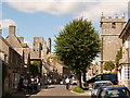
Corfe Castle: West Street
Looking towards the village centre, with the castle ruins and the parish church dwarfing their neighbours.
Image: © Chris Downer
Taken: 30 Aug 2010
0.01 miles