
IMAGES TAKEN NEAR TO
Grange Road, WAREHAM, BH20 5AJ
Introduction
This page details the photographs taken nearby to Grange Road, BH20 5AJ by members of the Geograph project.
The Geograph project started in 2005 with the aim of publishing, organising and preserving representative images for every square kilometre of Great Britain, Ireland and the Isle of Man.

There are currently over 7.5m images from over14,400 individuals and you can help contribute to the project by visiting https://www.geograph.org.uk
Image Map
Images are licensed for reuse under creativecommons.org/licenses/by-sa/2.0
Notes
- Clicking on the map will re-center to the selected point.
- The higher the marker number, the further away the image location is from the centre of the postcode.
Image Listing (26 Images Found)
Images are licensed for reuse under creativecommons.org/licenses/by-sa/2.0
Image
Details
Distance
1
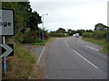
West Lane near junction with A351
The junction of West Lane with the main road has been realigned. The badly designed cycle route and crossings around this point utilise pavements and the old road alignment which cuts off the corner.
Image: © Phil Champion
Taken: 23 Sep 2009
0.04 miles
2
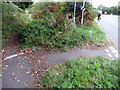
Cycle path - West Lane near junction with A351
Like many so called cycle 'facilities' this section of cycle path is poorly maintained; in this case overgrown from the sides. I'm still not sure which way the designers were intending cyclists to go. See Image for a wider view. Note the cyclist sticking to the carriageway.
Image: © Phil Champion
Taken: 23 Sep 2009
0.04 miles
3
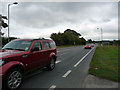
A351 near turning for Stoborough and Wareham
Image: © Phil Champion
Taken: 23 Sep 2009
0.04 miles
4
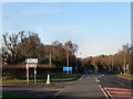
A351/West Lane Junction
The A351 at its junction with West Lane, the turn off for Creech.
Image: © David Dixon
Taken: 18 Dec 2012
0.06 miles
7
A351 - Stoborough and Wareham bypass
A less interesting but certainly quicker way to leave the Isle of Purbeck.
Image: © Robin Webster
Taken: 30 Oct 2012
0.14 miles
9
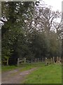
Start of a footpath into the Frome valley
This footpath is a dead end; Derek Harper explored its muddiness Image
Image: © David Smith
Taken: 30 Mar 2017
0.17 miles
10
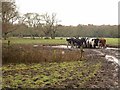
Cattle near Stoborough
The cattle are intent on their feed, although one has just clocked my arrival. This is on footpath SE5/13, which reaches a dead end at the River Frome, and is very muddy on the way there.
Image: © Derek Harper
Taken: 21 Jan 2010
0.18 miles