
IMAGES TAKEN NEAR TO
Corfe Road, WAREHAM, BH20 5AD
Introduction
This page details the photographs taken nearby to Corfe Road, BH20 5AD by members of the Geograph project.
The Geograph project started in 2005 with the aim of publishing, organising and preserving representative images for every square kilometre of Great Britain, Ireland and the Isle of Man.

There are currently over 7.5m images from over14,400 individuals and you can help contribute to the project by visiting https://www.geograph.org.uk
Image Map
Images are licensed for reuse under creativecommons.org/licenses/by-sa/2.0
Notes
- Clicking on the map will re-center to the selected point.
- The higher the marker number, the further away the image location is from the centre of the postcode.
Image Listing (36 Images Found)
Images are licensed for reuse under creativecommons.org/licenses/by-sa/2.0
Image
Details
Distance
1
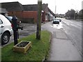
Stoborough: roadside pump
This pump stands alongside the main road through Stoborough, next to the Image which is behind the telegraph pole.
There is another, more ornately presented pump on the corner of the village green – Image – which is just visible in the distance.
Image: © Chris Downer
Taken: 17 Jan 2009
0.00 miles
2
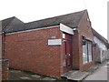
Stoborough: the old post office
The village store and post office in Stoborough closed in the early 2000s, but the words STOBOROUGH POST OFFICE can still be faintly discerned above the door, where the lettering has been removed.
Image: © Chris Downer
Taken: 17 Jan 2009
0.02 miles
3
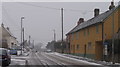
Stoborough Dorset
Corfe Road through Stoborough from Wareham to Corfe Castle(4mls) and Swanage(9mls)
Image: © Peter Elsdon
Taken: 1 Mar 2018
0.02 miles
4

Stoborough
A small village, immediately south of Wareham. Note the signs for a bus stop and cycle routes.
Image: © Peter Trimming
Taken: 18 Apr 2015
0.04 miles
5
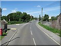
The B3075 Corfe Road at West Lane junction
Image: © Roy Hughes
Taken: 25 May 2024
0.06 miles
6
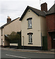
Old Toll House by the B3075, Corfe Road, Stoborough
Toll House by the B3075, in the parish of Wareham Town (Purbeck District), Weighbridge Cottage, Corfe Road, Stoborough, BH20.
Surveyed
Milestone Society National ID: DO.WAR
Image: © Alan Rosevear
Taken: 3 Apr 2008
0.07 miles
7
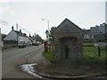
Stoborough, village pump
At the junction of Corfe Road & West Lane; appears to have been restored,looking at the plaque in the top right, as a war memorial containing the names of 11 participants in the First World War, and 7 in the Second. For another view, see http://www.arneparishcouncil.org.uk/arne_jubilee/parchment/page14.html
Image: © Mike Faherty
Taken: 2 May 2009
0.07 miles
8
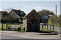
Stoborough
Village pump, on the junction with West Lane.
Image: © Peter Trimming
Taken: 18 Apr 2015
0.08 miles
9
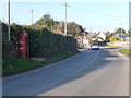
Stoborough: phone box in West Lane
This telephone box stands almost hidden in a hedge, opposite the village green.
Image: © Chris Downer
Taken: 2 Mar 2013
0.08 miles
10
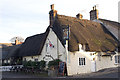
Kings Arms, Stoborough, Dorset
A warm and friendly pub, where you are unlikely to be troubled by unruly children, if the sign at the entrance is anything to go by: ‘Well behaved children welcome. Failure to comply will result in clamping (at parental cost), or sold as slaves’
Image: © John Lamper
Taken: 19 Nov 2005
0.09 miles