
IMAGES TAKEN NEAR TO
Christmas Close, WAREHAM, BH20 4RN
Introduction
This page details the photographs taken nearby to Christmas Close, BH20 4RN by members of the Geograph project.
The Geograph project started in 2005 with the aim of publishing, organising and preserving representative images for every square kilometre of Great Britain, Ireland and the Isle of Man.

There are currently over 7.5m images from over14,400 individuals and you can help contribute to the project by visiting https://www.geograph.org.uk
Image Map
Images are licensed for reuse under creativecommons.org/licenses/by-sa/2.0
Notes
- Clicking on the map will re-center to the selected point.
- The higher the marker number, the further away the image location is from the centre of the postcode.
Image Listing (114 Images Found)
Images are licensed for reuse under creativecommons.org/licenses/by-sa/2.0
Image
Details
Distance
1
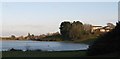
Wareham - Workhouse
The large white building overlooking Wareham Common was built in 1838 as Wareham and Purbeck Union workhouse, it is now residential accommodation.
Image: © Peter Elsdon
Taken: 30 Nov 2009
0.01 miles
2

Wareham Hospital
On Streche Road, as seen from Image http://www.dorset-pct.nhs.uk/health_services/community_hospitals/wareham/index.asp
Image: © Mike Faherty
Taken: 24 Jul 2010
0.04 miles
3

Wareham, farm track
Track and right of way from Streche Road to West Mills; by-pass in the distance.
Image: © Mike Faherty
Taken: 24 Jul 2010
0.06 miles
5

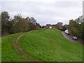
Wareham, town walls
Saxon wall dating from C8, originally covered in palisades, and later topped by a stone wall; this section is on the western side of the town.
Image: © Mike Faherty
Taken: 24 Jul 2010
0.08 miles
6
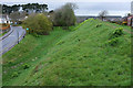
Bloody Bank, Wareham
Also shown in Image "After the Monmouth Rebellion of 1685, Wareham was one of a number of towns in Dorset where Judge Jeffreys held the Bloody Assizes, with five rebels being hanged, drawn and quartered on the West Walls, an area known as 'Bloody Bank'" https://en.wikipedia.org/wiki/Wareham,_Dorset . https://historicengland.org.uk/listing/the-list/list-entry/1003574
Image: © Derek Harper
Taken: 4 Apr 2019
0.08 miles
7
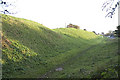
Saxon Walls, Wareham, Dorset
Wareham’s Saxon walls are ancient earth ramparts surrounding the town. The walls were built by Alfred the Great in the 9th century to defend the town from Norsemen.
Image: © John Lamper
Taken: 19 Nov 2005
0.09 miles
8
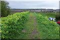
Town walls, Wareham
Footpath SE2 13 runs between alexanders along the top of the rampart https://historicengland.org.uk/listing/the-list/list-entry/1003574 towards the Piddle valley. On the other side is Northport.
Image: © Derek Harper
Taken: 4 Apr 2019
0.09 miles
9

Piddle valley at Wareham
Looking up the valley from the northwest corner of the Town Walls https://historicengland.org.uk/listing/the-list/list-entry/1003574 . Lined with gorse bushes, the A351 crosses the river in the centre.
Image: © Derek Harper
Taken: 4 Apr 2019
0.10 miles
10

Wareham, Piddle valley
Looking down into the valley from the north-western corner of the town walls, with water meadows and North Bridge in the distance.
Image: © Mike Faherty
Taken: 24 Jul 2010
0.10 miles