IMAGES TAKEN NEAR TO
New Street, WAREHAM, BH20 4QS
Introduction
This page details the photographs taken nearby to New Street, BH20 4QS by members of the Geograph project.
The Geograph project started in 2005 with the aim of publishing, organising and preserving representative images for every square kilometre of Great Britain, Ireland and the Isle of Man.

There are currently over 7.5m images from over14,400 individuals and you can help contribute to the project by visiting https://www.geograph.org.uk
Image Map
Images are licensed for reuse under creativecommons.org/licenses/by-sa/2.0
Notes
- Clicking on the map will re-center to the selected point.
- The higher the marker number, the further away the image location is from the centre of the postcode.
Image Listing (504 Images Found)
Images are licensed for reuse under creativecommons.org/licenses/by-sa/2.0
Image
Details
Distance
2
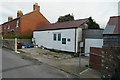
A shed by the walls
A small workshop for the Rempstone Estate, in West Walls, Wareham
Image: © Bob Harvey
Taken: 22 Nov 2015
0.04 miles
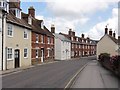
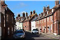
3
Cow Lane, Wareham
Seen from the Town Walls. The thatched cottage right of centre is listed https://historicengland.org.uk/listing/the-list/list-entry/1120009 .
Image: © Derek Harper
Taken: 4 Apr 2019
0.05 miles
4
Old and New
The older premises on the north of West Street are going to have their light blocked by the new buildings going up on the other side.
Image: © Bob Harvey
Taken: 22 Nov 2015
0.05 miles
5
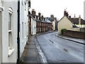
West Street, Wareham
Looking towards the cross-roads at the town centre, after a sudden late afternoon shower.
Image: © Stefan Czapski
Taken: 29 Apr 2011
0.05 miles
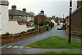
8
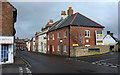
West Street, Wareham
The B3070 enters the town centre.
Image: © Derek Harper
Taken: 4 Apr 2019
0.06 miles
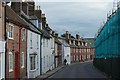
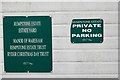
9
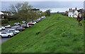
Town walls, Wareham
The west side of the walls, with a car park to the left. The ancient monument is described at https://historicengland.org.uk/listing/the-list/list-entry/1003574 . "On the western side, where best preserved, the rampart is 3.6m high above the interior and 7.9m high above the base of the ditch." Along the top runs footpath SE2 13.
Image: © Derek Harper
Taken: 4 Apr 2019
0.06 miles
10
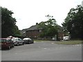
Wareham, Westport House
On Worgret Road; headquarters of Purbeck District Council. http://www.dorsetforyou.com/purbeck
Image: © Mike Faherty
Taken: 24 Jul 2010
0.06 miles