
IMAGES TAKEN NEAR TO
North Bestwall, WAREHAM, BH20 4HT
Introduction
This page details the photographs taken nearby to BH20 4HT by members of the Geograph project.
The Geograph project started in 2005 with the aim of publishing, organising and preserving representative images for every square kilometre of Great Britain, Ireland and the Isle of Man.

There are currently over 7.5m images from over14,400 individuals and you can help contribute to the project by visiting https://www.geograph.org.uk
Image Map
Images are licensed for reuse under creativecommons.org/licenses/by-sa/2.0
Notes
- Clicking on the map will re-center to the selected point.
- The higher the marker number, the further away the image location is from the centre of the postcode.
Image Listing (131 Images Found)
Images are licensed for reuse under creativecommons.org/licenses/by-sa/2.0
Image
Details
Distance
1
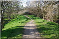
On top of the town wall, Wareham
Part of the remains of the Anglo-Saxon walls around the town. Now used as a town walk.
Image: © N Chadwick
Taken: 8 Apr 2008
0.02 miles
2
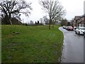
Town walls beside Bells Orchard Lane
A modern residential street just inside the walls of Wareham
Image: © David Smith
Taken: 24 Jan 2018
0.03 miles
3
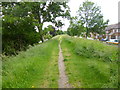
Wareham, Walls Walk
A path on the top of the town's Saxon walls: http://www.dorsetforyou.com/396465
Image: © Mike Faherty
Taken: 16 Jun 2013
0.03 miles
4
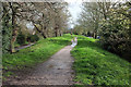
Town walls, Wareham
On the eastern art of the Saxon defences https://historicengland.org.uk/listing/the-list/list-entry/1003574 , following footpath SE2 24 .
Image: © Derek Harper
Taken: 4 Apr 2019
0.03 miles
5
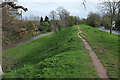
Wareham Town Walls
A break in the trees a bit further down footpath SE2 14#1 from where Image was taken. On the left is North Bestwall Road, on the right, Bells Orchard Lane. https://historicengland.org.uk/listing/the-list/list-entry/1003574
Image: © Derek Harper
Taken: 4 Apr 2019
0.03 miles
6
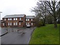
Houses and the town walls, Bells Orchard Lane
Image: © David Smith
Taken: 24 Jan 2018
0.05 miles
7
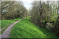
Poole Harbour Trail on Wareham Town Walls
A little further along footpath SE2 14#1 from Image] https://historicengland.org.uk/listing/the-list/list-entry/1003574 . It's about here that the Poole Harbour Trail veers off to the left.
Image: © Derek Harper
Taken: 4 Apr 2019
0.05 miles
8

Town walls, Wareham
Looking in the opposite direction from where Image] was taken, approaching the Bowling Green. https://historicengland.org.uk/listing/the-list/list-entry/1003574
Image: © Derek Harper
Taken: 4 Apr 2019
0.07 miles
9
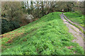
Poole Harbour Trail on Wareham Town Walls
Footpath SE2 14#1 curves to head down the eastern edge of the town along the Saxon ramparts. https://historicengland.org.uk/listing/the-list/list-entry/1003574 .
Image: © Derek Harper
Taken: 4 Apr 2019
0.08 miles
10
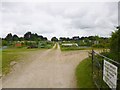
Wareham, allotments
Off North Bestwall Road.
Image: © Mike Faherty
Taken: 16 Jun 2013
0.09 miles