
IMAGES TAKEN NEAR TO
Northmoor Way, WAREHAM, BH20 4EX
Introduction
This page details the photographs taken nearby to Northmoor Way, BH20 4EX by members of the Geograph project.
The Geograph project started in 2005 with the aim of publishing, organising and preserving representative images for every square kilometre of Great Britain, Ireland and the Isle of Man.

There are currently over 7.5m images from over14,400 individuals and you can help contribute to the project by visiting https://www.geograph.org.uk
Image Map
Images are licensed for reuse under creativecommons.org/licenses/by-sa/2.0
Notes
- Clicking on the map will re-center to the selected point.
- The higher the marker number, the further away the image location is from the centre of the postcode.
Image Listing (19 Images Found)
Images are licensed for reuse under creativecommons.org/licenses/by-sa/2.0
Image
Details
Distance
1
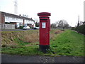
Wareham: postbox № BH20 295, Northmoor Way
This postbox, serving the northern half of this fairly modern estate, is emptied finally at 5:30pm on weekdays and at 12:30pm on Saturdays.
Just visible, attached to the back of the postbox, is a drop box (see below).
Image: © Chris Downer
Taken: 17 Jan 2009
0.06 miles
2
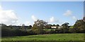
Wareham
Walking from the Golf Course towards Northmoor Park. Houses in the far right are in Seven Barrows Road.
Image: © Peter Elsdon
Taken: 17 Nov 2009
0.09 miles
3
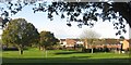
Wareham - Northmoor Park
Hausers Field 'Field of Dreams' with Burns Road through the five bar gate to the right. Stockley Road just beyond the first row of houses.
Image: © Peter Elsdon
Taken: 17 Nov 2009
0.10 miles
4
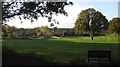
Wareham - Northmoor Park
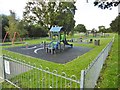
Skate Park in Hauses Field. Houses behind in area of Trent Drive, Willow Way.
Image: © Peter Elsdon
Taken: 17 Nov 2009
0.10 miles
5
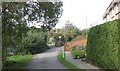
Wareham Forest Walk
Track from Northmoor Park bearing right leading to Wareham Forest across the Golf Course. Straight ahead Tantinoby Farm
Image: © Peter Elsdon
Taken: 14 Oct 2009
0.11 miles
6
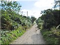
Wareham, bridleway
From Wareham Forest to Northport.
Image: © Mike Faherty
Taken: 10 Oct 2016
0.12 miles
7
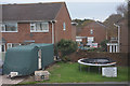
Wareham : Northmoor Way
Houses and a trampoline seen here on Northmoor Way.
Image: © Lewis Clarke
Taken: 28 Oct 2017
0.16 miles
9
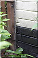
Benchmark on #2Egdon Road
Ordnance Survey cut mark benchmark described on the Bench Mark Database at http://www.bench-marks.org.uk/bm23677
Image: © Roger Templeman
Taken: 8 Jul 2011
0.16 miles
10
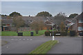
Wareham : Northmoor Way
Looking along Northmoor Way in Wareham.
Image: © Lewis Clarke
Taken: 28 Oct 2017
0.17 miles