
IMAGES TAKEN NEAR TO
Courtenay Close, WAREHAM, BH20 4ED
Introduction
This page details the photographs taken nearby to Courtenay Close, BH20 4ED by members of the Geograph project.
The Geograph project started in 2005 with the aim of publishing, organising and preserving representative images for every square kilometre of Great Britain, Ireland and the Isle of Man.

There are currently over 7.5m images from over14,400 individuals and you can help contribute to the project by visiting https://www.geograph.org.uk
Image Map
Images are licensed for reuse under creativecommons.org/licenses/by-sa/2.0
Notes
- Clicking on the map will re-center to the selected point.
- The higher the marker number, the further away the image location is from the centre of the postcode.
Image Listing (21 Images Found)
Images are licensed for reuse under creativecommons.org/licenses/by-sa/2.0
Image
Details
Distance
1
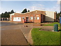
Wareham: Royal Mail delivery office
Wareham's sorting office is at the far end of Sandford Lane Industrial Estate.
Image: © Chris Downer
Taken: 22 Nov 2009
0.09 miles
2
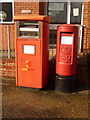
Wareham: postbox №s BH20 2000 and BH20 400, Sandford Lane
These two postboxes stand outside Image, and thus have the latest collection times in the area – 6pm on weekdays and 12:30pm on Saturdays.
The one on the right (box № 2000) is for ordinary stamped mail while the left-hand box is for franked mail (see below).
Image: © Chris Downer
Taken: 22 Nov 2009
0.09 miles
3
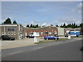
Wareham Delivery Office
On Sandford Lane, in the industrial estate.
Image: © Mike Faherty
Taken: 24 Jul 2010
0.10 miles
4
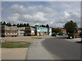
Wareham, industrial estate
Sandford Lane Industrial Estate, on Sandford Lane.
Image: © Mike Faherty
Taken: 24 Jul 2010
0.11 miles
6
Gateway to the Jurassic Coast
Confusingly referred to on the UNESCO website as the 'Dorset and East Devon Coast'. Awarded the status as a heritage site in 2001.
Image: © Mr Ignavy
Taken: 6 May 2010
0.16 miles
7
Milestone beside Sandford Road (A351)
See https://www.geograph.org.uk/photo/5624022
Milestone Society National ID: DO_WAPO01.
Image: © JThomas
Taken: 24 Mar 2022
0.16 miles
8
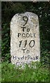
Old Milestone by the A351, Sandford, Wareham
Carved stone post by the A351, in parish of WAREHAM TOWN (PURBECK District), South of roundabout with B3075; opposite end of slip road to houses on other side of road. 3m back from road against gorse hedge, on North West side of road. Poole stone, erected by the Poole turnpike trust in the 19th century.
Inscription reads:-
: 9 / To / Poole / 110 / To / Hyde Park / Corner : : 1 / From / Wareham :
Grade II Listed. List Entry Number:1119969
https://historicengland.org.uk/listing/the-list/list-entry/1119969
Milestone Society National ID: DO_WAPO01.
Image: © J Tybjerg
Taken: 5 Sep 2002
0.16 miles
9
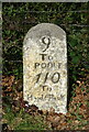
Milestone beside Sandford Road (A351)
See https://www.geograph.org.uk/photo/5624022
Milestone Society National ID: DO_WAPO01.
Image: © JThomas
Taken: 24 Mar 2022
0.16 miles
10
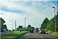
Welcome to Wareham, gateway to the Jurassic Coast
So says the sign. The A351 veers away from its old course on the left to bypass the newer part of Wareham north of the River Piddle.
Image: © Robin Webster
Taken: 30 Oct 2012
0.16 miles