IMAGES TAKEN NEAR TO
Blacklands, SWANAGE, BH19 3LD
Introduction
This page details the photographs taken nearby to Blacklands, BH19 3LD by members of the Geograph project.
The Geograph project started in 2005 with the aim of publishing, organising and preserving representative images for every square kilometre of Great Britain, Ireland and the Isle of Man.

There are currently over 7.5m images from over14,400 individuals and you can help contribute to the project by visiting https://www.geograph.org.uk
Image Map (Loading...)


Getting Data...Please wait
Leaflet Map data © OpenStreetMap
Images are licensed for reuse under creativecommons.org/licenses/by-sa/2.0
Notes
- Clicking on the map will re-center to the selected point.
- The higher the marker number, the further away the image location is from the centre of the postcode.
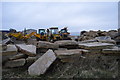
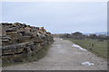
Image Listing (27 Images Found)
Images are licensed for reuse under creativecommons.org/licenses/by-sa/2.0
Image
Details
Distance
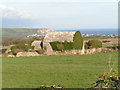
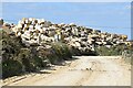
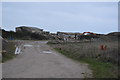
2
Clifftop Walk 02
Near the junction of the path to Acton and the Priests Way.
Image: © Row17
Taken: 2 Oct 2014
0.05 miles
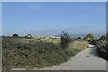
9
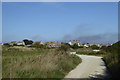
Clifftop Walk 01
From Acton to Swanage this walk mainly follows the South West Coast Path from Seacombe Cliffs to central Swanage. This image is near the start of the walk at Acton.
Image: © Row17
Taken: 2 Oct 2014
0.11 miles