IMAGES TAKEN NEAR TO
Watery Lane, SWANAGE, BH19 3AW
Introduction
This page details the photographs taken nearby to Watery Lane, BH19 3AW by members of the Geograph project.
The Geograph project started in 2005 with the aim of publishing, organising and preserving representative images for every square kilometre of Great Britain, Ireland and the Isle of Man.

There are currently over 7.5m images from over14,400 individuals and you can help contribute to the project by visiting https://www.geograph.org.uk
Image Map (Loading...)


Getting Data...Please wait
Leaflet Map data © OpenStreetMap
Images are licensed for reuse under creativecommons.org/licenses/by-sa/2.0
Notes
- Clicking on the map will re-center to the selected point.
- The higher the marker number, the further away the image location is from the centre of the postcode.
Image Listing (278 Images Found)
Images are licensed for reuse under creativecommons.org/licenses/by-sa/2.0
Image
Details
Distance
2
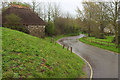
Watery Lane, Studland
Taken beside the cross shown in http://www.geograph.org.uk/search.php?i=102850309 , at the junction with Church Road. The building on the left is some sort of shelter.
Image: © Derek Harper
Taken: 5 Apr 2019
0.04 miles
3
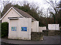
Studland public conveniences and sewage pumping station
These conveniences are at the bottom of the hill, at the bend in the road where the footpath to Old Harry Rocks leads east.
Image: © Jim Champion
Taken: 10 Dec 2005
0.05 miles
5
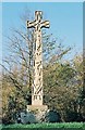
Studland: the cross (south side)
Sculpted in 1976 and placed on a substantially earlier base. The other side can be seen hrer: Image
Image: © Chris Downer
Taken: Unknown
0.05 miles
6
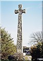
Studland: the cross (north side)
See Image for more details.
Image: © Chris Downer
Taken: Unknown
0.05 miles
7
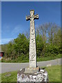
Cross at the end of Watery Lane, Studland
The modern Celtic cross was erected in 1976. Manor Farm is to the left of the picture and School Lane is on the right.
Image: © pam fray
Taken: 4 May 2016
0.05 miles
8
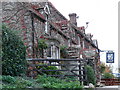
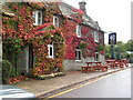
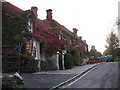
The Bankes Arms Studland
The Beer Garden overlooks the coast and a footpath leads down to the edge
Image: © Susannah Muldoon
Taken: 31 Oct 2007
0.05 miles

10
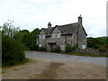
Studland, Manor Farmhouse
On Manor Road.
Image: © Mike Faherty
Taken: 27 May 2011
0.06 miles