
IMAGES TAKEN NEAR TO
Bognor Road, BROADSTONE, BH18 9HA
Introduction
This page details the photographs taken nearby to Bognor Road, BH18 9HA by members of the Geograph project.
The Geograph project started in 2005 with the aim of publishing, organising and preserving representative images for every square kilometre of Great Britain, Ireland and the Isle of Man.

There are currently over 7.5m images from over14,400 individuals and you can help contribute to the project by visiting https://www.geograph.org.uk
Image Map
Images are licensed for reuse under creativecommons.org/licenses/by-sa/2.0
Notes
- Clicking on the map will re-center to the selected point.
- The higher the marker number, the further away the image location is from the centre of the postcode.
Image Listing (20 Images Found)
Images are licensed for reuse under creativecommons.org/licenses/by-sa/2.0
Image
Details
Distance
1
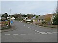
Bognor Road, Broadstone
Bognor Road is a minor residential road in Broadstone, near Poole. Bungalows form most of the housing in this area.
Image: © Malc McDonald
Taken: 7 Feb 2022
0.06 miles
2
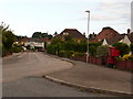
Broadstone: postbox № BH18 167, Ascot Road
Looking along the southern section of Ascot Road past this Elizabeth II-reign postbox, which is leaning backwards slightly and is emptied finally at 5:30pm on weekdays and at 11:45am on Saturdays.
Image: © Chris Downer
Taken: 12 Jul 2009
0.10 miles
3
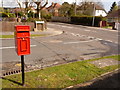
Broadstone: postbox № BH18 101, Abbotsbury Road
This postbox has been installed only very recently, replacing one very nearby on Springdale Road – the road we see to the right – which had been damaged in a vehicle collision. It is so new that the collection information plate has not yet been affixed.
Image: © Chris Downer
Taken: 2 Apr 2010
0.11 miles
4
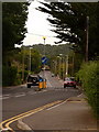
Broadstone: Springdale Road
From west to east, Springdale Road runs in a dead-straight line for about 1km, does a turn to the left and continues for about another 1km, again dead-straight but for one small kink which we see here.
Image: © Chris Downer
Taken: 12 Jul 2009
0.13 miles
5
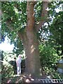
Old Oak in Broadstone
This oak is in the front garden of 5 Higher Blandford Road and is 4.27 metres in girth. When the owner's house was built in 1946, a brook ran between the oak and the South hedge. There used to be stepping stones over the brook where it crossed the road outside, these stones may be the origin of the village's name. Alas, the brook is now piped underground, the road is tarmaced and the stones have gone. But the great oak still stands, perhaps 400 years old.
Image: © John Palmer
Taken: 9 Jul 2010
0.17 miles
6
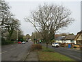
Higher Blandford Road, Broadstone, near Poole
Higher Blandford Road heading out of Broadstone, near Poole. The road forms part of the route of the B3074.
This image was taken on a February day. Most of the trees were bare for the winter months.
Image: © Malc McDonald
Taken: 7 Feb 2022
0.17 miles
7
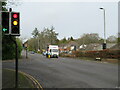
Higher Blandford Road, Broadstone, near Poole
A traffic light-controlled junction on Higher Blandford Road in Broadstone, on the outskirts of Poole. This road forms part of the route of the B3074.
Image: © Malc McDonald
Taken: 7 Feb 2022
0.18 miles
8
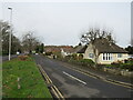
Higher Blandford Road, Broadstone, near Poole
Higher Blandford Road forms part of the B3074 road passing through Broadstone, a suburb of Poole. Here, there is a parallel side road in front of the houses.
Image: © Malc McDonald
Taken: 7 Feb 2022
0.18 miles
9
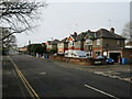
Clarendon Road, Broadstone
Clarendon Road is a residential road in Broadstone, a suburb of Poole.
Image: © Malc McDonald
Taken: 7 Feb 2022
0.19 miles
10
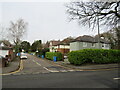
Clarendon Close, Broadstone
Clarendon Close is a residential cul-de-sac in Broadstone, on the outskirts of Poole.
Image: © Malc McDonald
Taken: 7 Feb 2022
0.19 miles