
IMAGES TAKEN NEAR TO
High Park Road, BROADSTONE, BH18 9DE
Introduction
This page details the photographs taken nearby to High Park Road, BH18 9DE by members of the Geograph project.
The Geograph project started in 2005 with the aim of publishing, organising and preserving representative images for every square kilometre of Great Britain, Ireland and the Isle of Man.

There are currently over 7.5m images from over14,400 individuals and you can help contribute to the project by visiting https://www.geograph.org.uk
Image Map
Images are licensed for reuse under creativecommons.org/licenses/by-sa/2.0
Notes
- Clicking on the map will re-center to the selected point.
- The higher the marker number, the further away the image location is from the centre of the postcode.
Image Listing (24 Images Found)
Images are licensed for reuse under creativecommons.org/licenses/by-sa/2.0
Image
Details
Distance
1
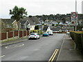
Lewesdon Drive, Broadstone
Lewesdon Drive is a residential road in Broadstone, on the outskirts of Poole.
Image: © Malc McDonald
Taken: 7 Feb 2022
0.11 miles
2
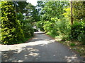
Broadstone, bridleway
Linking two sections of Roman Road, on the course of the Roman road from Hamworthy to Badbury; the bridleway here also serves as a private road, serving properties, and as the boundary between East Dorset (left) and Poole (right).
Image: © Mike Faherty
Taken: 14 Jun 2011
0.14 miles
3
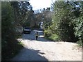
Roman Road, Corfe Mullen
A bit of the old Roman Road still not tarmaced. The Romans landed in Hamworthy from Poole Harbour about AD 45, and marched inland under Vespasian (future emperor) to Lake on the Stour, where they established a vexillation fortress for 4,500 veteran soldiers. Lake served as their HQ till it was moved to Exeter 5 years later.
Image: © John Palmer
Taken: 30 Mar 2009
0.14 miles
4
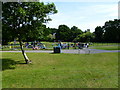
Broadstone, Springdale Play Area
Off Leweson Drive. http://www.boroughofpoole.com/facilities/ref:F465e9bc7468cc/
Image: © Mike Faherty
Taken: 14 Jun 2011
0.14 miles
5
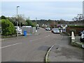
Wynne Close, Broadstone
Wynne Close is a residential cul-de-sac in Broadstone, on the outskirts of Poole.
Image: © Malc McDonald
Taken: 7 Feb 2022
0.16 miles
6
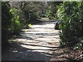
Roman Road, Broadstone
This untarmaced bit of the old Roman Road forms the border between Broadstone and Corfe Mullen.
Image: © John Palmer
Taken: 30 Mar 2009
0.16 miles
7

Broadstone, Springdale First School
On Springdale Road. http://www.springdaleschool.org.uk/welcome.asp
Image: © Mike Faherty
Taken: 14 Jun 2011
0.16 miles
8
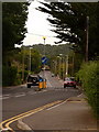
Broadstone: Springdale Road
From west to east, Springdale Road runs in a dead-straight line for about 1km, does a turn to the left and continues for about another 1km, again dead-straight but for one small kink which we see here.
Image: © Chris Downer
Taken: 12 Jul 2009
0.17 miles
9
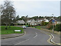
Lewesdon Drive, Broadstone
Houses on Lewesdon Drive in Broadstone, on the outskirts of Poole. This section of the road is a cul-de-sac which branches off the main part of Lewesdon Drive.
Image: © Malc McDonald
Taken: 7 Feb 2022
0.17 miles
10
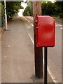
Broadstone: postbox № BH18 77, Springdale Road
Beyond this postbox, we look up a long straight stretch of Springdale Road just as it crosses the Roman Road which forms the Poole borough boundary. The sign welcoming us to Corfe Mullen (in East Dorset district) from Poole can just be discerned in the distance, above the bench.
The postbox is emptied finally at 5:30pm on weekdays and at 11:45am on Saturdays.
Image: © Chris Downer
Taken: 12 Jul 2009
0.17 miles