
IMAGES TAKEN NEAR TO
Deneve Avenue, POOLE, BH17 9LR
Introduction
This page details the photographs taken nearby to Deneve Avenue, BH17 9LR by members of the Geograph project.
The Geograph project started in 2005 with the aim of publishing, organising and preserving representative images for every square kilometre of Great Britain, Ireland and the Isle of Man.

There are currently over 7.5m images from over14,400 individuals and you can help contribute to the project by visiting https://www.geograph.org.uk
Image Map
Images are licensed for reuse under creativecommons.org/licenses/by-sa/2.0
Notes
- Clicking on the map will re-center to the selected point.
- The higher the marker number, the further away the image location is from the centre of the postcode.
Image Listing (13 Images Found)
Images are licensed for reuse under creativecommons.org/licenses/by-sa/2.0
Image
Details
Distance
1
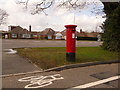
Waterloo: postbox № BH17 164, Waterloo Road
This Edward VII-reign postbox stands with its back to the busy A349, Waterloo Road, but faces a parallel service-road which is one-way for motorists but allows cyclists to travel in either direction.
The postbox is emptied finally at 5:15pm on weekdays and at 12:15pm on Saturdays.
Image: © Chris Downer
Taken: 2 Apr 2010
0.06 miles
2
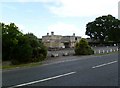
Waterloo, Darbys Corner
Closed pub next to the roundabout of the same name, on Waterloo Road; the brewery closed it at short notice, and signage has now gone. http://www.bournemouthecho.co.uk/yoursay/letterstotheeditor/9003150.Loss_of_Darby_s_corner_is_sad/ ; the establishment seems to have had a mixed recent history: http://www.beerintheevening.com/pubs/comments.shtml/2803/
Image: © Mike Faherty
Taken: 18 Jun 2011
0.08 miles
4
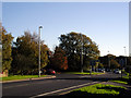
Darby's Corner, Poole
Looking south east from the B3074 Lower Blandford Road to Darby's Corner roundabout. This is a busy roundabout in north Poole. The other roads meeting here are Gravel Hill, Waterloo Road and Canford Heath Road.
Image: © Peter Jordan
Taken: 19 Nov 2005
0.12 miles
5
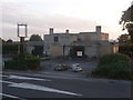
Waterloo: the Darby?s Corner Inn
Another casualty of the licensed trade, this pub is - was - named after the road junction close to which it stands. It is of a fairly distinctive shape and has been closed for a month or two to my knowledge, maybe longer.
Image: © Chris Downer
Taken: 21 Jun 2011
0.12 miles
6
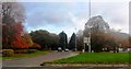
Autumn colours, Darby's Corner, Poole
Image: © nick macneill
Taken: 19 Nov 2011
0.16 miles
7
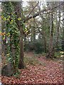
Canford Heath, nature reserve
Plantation Woodland Local Nature Reserve, on Canford Heath Road; a thin wedge of deciduous woodland.
Image: © Mike Faherty
Taken: 22 Nov 2009
0.18 miles
8
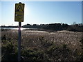
Poole : Hatch Pond Local Nature Reserve
This sign could be a danger sign, or it could be warning of anger. Could go either way.
Image: © Lewis Clarke
Taken: 8 Mar 2010
0.23 miles
9
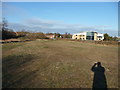
Poole : Stinsford Road Grassy Field
A grassy area between Stinsford Road and the local nature reserve.
Image: © Lewis Clarke
Taken: 8 Mar 2010
0.24 miles
10
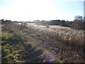
Poole : Hatch Pond Local Nature Reserve
The nature reserve is managed by Poole Borough Council and is situated between housing and industrial estates.
Image: © Lewis Clarke
Taken: 8 Mar 2010
0.24 miles