
IMAGES TAKEN NEAR TO
Knowlton Road, POOLE, BH17 9ED
Introduction
This page details the photographs taken nearby to Knowlton Road, BH17 9ED by members of the Geograph project.
The Geograph project started in 2005 with the aim of publishing, organising and preserving representative images for every square kilometre of Great Britain, Ireland and the Isle of Man.

There are currently over 7.5m images from over14,400 individuals and you can help contribute to the project by visiting https://www.geograph.org.uk
Image Map
Images are licensed for reuse under creativecommons.org/licenses/by-sa/2.0
Notes
- Clicking on the map will re-center to the selected point.
- The higher the marker number, the further away the image location is from the centre of the postcode.
Image Listing (31 Images Found)
Images are licensed for reuse under creativecommons.org/licenses/by-sa/2.0
Image
Details
Distance
1

Poole : Canford Heath Road B3074
Cars travelling along the road and a jogger makes the best out of the sunshine.
Image: © Lewis Clarke
Taken: 8 Mar 2010
0.07 miles
2

Poole : Canford Heath Road B3074
Looking up the road with cars and a cyclist on the path.
Image: © Lewis Clarke
Taken: 8 Mar 2010
0.08 miles
3

Poole : Canford Heath Footpath
A footpath taken from a small bridge on Canford Heath Road looking down onto the path.
Image: © Lewis Clarke
Taken: 8 Mar 2010
0.10 miles
4
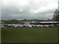
Canford Heath, supermarket
Asda, off Culliford Crescent, in the Neighbourhood Centre.
Image: © Mike Faherty
Taken: 27 Nov 2009
0.10 miles
5
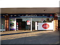
Canford Heath: Neighbourhood Centre Post Office
The post office, which opened in 1992, has a rather generic sounding branch name. It is contained within the Martin's newsagent, one of the Image, hence the absence of a door in the picture.
Image: © Chris Downer
Taken: 17 Jun 2014
0.11 miles
6
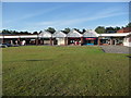
Canford Heath: shops in the Neighbourhood Centre
I'm not sure if the official name of this precinct is the Neighbourhood Centre, but that is the otherwise rather generic name of the Post Office branch which opened in 1992 and is visible to the left. The centre was built as part of the vast Canford Heath housing estate in the late 1970s/early 80s. Out of picture to the left is an Asda supermarket and to the right is Image The Asda petrol station, whose forecourt is just behind us, is often the cheapest in the Bournemouth-Poole conurbation.
Image: © Chris Downer
Taken: 17 Jun 2014
0.11 miles
7
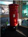
Canford Heath: replacement postbox № BH17 398
Five years or so ago, I photographed Image when it was out of order due to damage (see Image for a close-up of the notice).
It has been replaced by this modern plastic box in the porch entrance to the Asda supermarket, just a few yards from the exterior location of the old box.
Image: © Chris Downer
Taken: 17 Jun 2014
0.11 miles
8
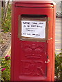
Canford Heath: out-of-service postbox
A close-up of the current state of Image
Image: © Chris Downer
Taken: 27 Jul 2009
0.11 miles
9

Canford Heath: postbox № BH17 398, Neighbourhood Centre
This postbox faces the Image, and is currently out of use thanks either to vandalism or accidental damage. The notice is shown in detail here: Image
Image: © Chris Downer
Taken: 27 Jul 2009
0.11 miles
10
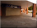
Canford Heath: Neighbourhood Centre Post Office
You would have thought that the Post Office might have named this branch something that more obviously narrowed it down to its location – Canford Heath would have been my choice if I'd been in charge of such matters – rather than the more generic sounding Neighbourhood Centre. Anyhow, it opened about 20 years ago, within this Martin's newsagent alongside the Asda supermarket, after the decade-long building of this vast housing estate had drawn to a finish.
Image: © Chris Downer
Taken: 27 Jul 2009
0.11 miles