
IMAGES TAKEN NEAR TO
Herstone Close, POOLE, BH17 8AT
Introduction
This page details the photographs taken nearby to Herstone Close, BH17 8AT by members of the Geograph project.
The Geograph project started in 2005 with the aim of publishing, organising and preserving representative images for every square kilometre of Great Britain, Ireland and the Isle of Man.

There are currently over 7.5m images from over14,400 individuals and you can help contribute to the project by visiting https://www.geograph.org.uk
Image Map
Images are licensed for reuse under creativecommons.org/licenses/by-sa/2.0
Notes
- Clicking on the map will re-center to the selected point.
- The higher the marker number, the further away the image location is from the centre of the postcode.
Image Listing (21 Images Found)
Images are licensed for reuse under creativecommons.org/licenses/by-sa/2.0
Image
Details
Distance
1
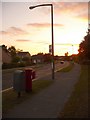
Canford Heath: postbox № BH17 285, Sherborn Crescent
This corner of the vast 70s Canford Heath housing estate features many roads apparently named after Dorset places, but with several of them misspelt: Sherborn rather than Sherborne; Yeatminster instead of Yetminster; Pimpern, not Pimperne; Hertsone as opposed to Herston. There are further examples of the correct spelling. In the distance is the turning of the last of my examples, Herstone Close.
This postbox is emptied finally at 5:30pm on weekdays and at noon on Saturdays.
Also are two drop boxes – a red one attached to the box and a separate, large grey one (see below).
Image: © Chris Downer
Taken: 14 Sep 2009
0.06 miles
2
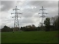
Canford Heath, electricity pylons
Part of a route from Upton to Hamworthy and Longham; as seen from open space next to Sherborn Crescent.
Image: © Mike Faherty
Taken: 27 Nov 2009
0.08 miles
3
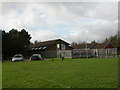
Canford Heath, Scout HQ
Headquarters of Poole North Scout Group, off Sherborn Crescent. http://pnsg.org.uk/
Image: © Mike Faherty
Taken: 27 Nov 2009
0.12 miles
4
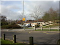
Canford Heath, first school
Ad Astra First School, at the junction of Sherborn Crescent and Adastral Road. http://www.adastra.poole.sch.uk/
Image: © Mike Faherty
Taken: 27 Nov 2009
0.14 miles
5

Poole : Canford Heath Road B3074
Cars travelling along the road and a jogger makes the best out of the sunshine.
Image: © Lewis Clarke
Taken: 8 Mar 2010
0.17 miles
6

Poole : Canford Heath Road B3074
Looking up the road with cars and a cyclist on the path.
Image: © Lewis Clarke
Taken: 8 Mar 2010
0.18 miles
7

Poole : Canford Heath Road Path
A path beside the road which goes underneath it at a tunnel.
Image: © Lewis Clarke
Taken: 8 Mar 2010
0.18 miles
8

Poole : Canford Heath Footpath
A footpath taken from a small bridge on Canford Heath Road looking down onto the path.
Image: © Lewis Clarke
Taken: 8 Mar 2010
0.19 miles
9
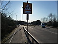
Poole : Canford Heath Road & School Sign
The patrol sign is used here to hide the flare of the sun which was getting into the lens.
Image: © Lewis Clarke
Taken: 8 Mar 2010
0.19 miles
10
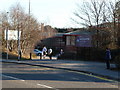
Poole : Adastral Road, Everyone Active Leisure Centre
Everyone Active manages this facility in partnership with Borough of Poole.
Image: © Lewis Clarke
Taken: 8 Mar 2010
0.20 miles