IMAGES TAKEN NEAR TO
Sandpiper Close, POOLE, BH17 7YE
Introduction
This page details the photographs taken nearby to Sandpiper Close, BH17 7YE by members of the Geograph project.
The Geograph project started in 2005 with the aim of publishing, organising and preserving representative images for every square kilometre of Great Britain, Ireland and the Isle of Man.

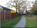
There are currently over 7.5m images from over14,400 individuals and you can help contribute to the project by visiting https://www.geograph.org.uk
Image Map
Images are licensed for reuse under creativecommons.org/licenses/by-sa/2.0
Notes
- Clicking on the map will re-center to the selected point.
- The higher the marker number, the further away the image location is from the centre of the postcode.
Image Listing (11 Images Found)
Images are licensed for reuse under creativecommons.org/licenses/by-sa/2.0
Image
Details
Distance
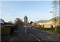
1
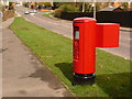
Creekmoor: postbox № BH17 270, Beechbank Avenue
This modern postbox serves the 1980s housing estate of western Creekmoor, and is emptied finally at 5:30pm on weekdays and at 12:15pm on Saturdays.
Image: © Chris Downer
Taken: 2 Apr 2010
0.09 miles
2
Pinesprings, Chaffinch Close
Side road off Beechbank Avenue; like most other roads on this part of the estate, named after native wild birds.
Image: © Mike Faherty
Taken: 22 Jun 2011
0.13 miles
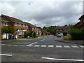
3
Chaffinch Close, Broadstone
All the streets in this very suburban part of Poole are named after common birds.
Image: © Nigel Mykura
Taken: 22 Nov 2009
0.15 miles
4
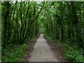
Pinesprings, railway trackbed
Once the Southampton to Dorchester railway, nicknamed "Castleman Corkscrew" because of its sinuous route; now the Castleman Trailway: http://www.dorsetforyou.com/castlemantrailway
Image: © Mike Faherty
Taken: 22 Jun 2011
0.16 miles
5
Footpath at the rear of houses in Honeysuckle Lane
Image: © Rod Allday
Taken: 27 Mar 2017
0.16 miles
6
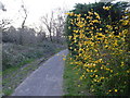
Footpath off Tarn Drive
Leading to Creekmoor ponds.
Image: © Rod Allday
Taken: 27 Mar 2017
0.19 miles
7
York Road, Broadstone
A mixed residential and industrial area on the northern outskirts of Poole.
Image: © Rod Allday
Taken: 27 Mar 2017
0.21 miles
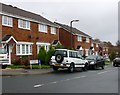
8
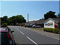
Waterloo, bungalows
On York Road, near the junction with Sopers Lane.
Image: © Mike Faherty
Taken: 3 Jul 2011
0.21 miles
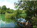
9
Pond on Creekmoor
The smaller of two flooded former sandpits in this 14 acre nature reserve.
Image: © Rod Allday
Taken: 27 Mar 2017
0.21 miles
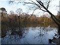
10
Creekmoor Ponds
The eastern of two former sandpits. Blue colouration of the water is probably caused by suspended clay particles. http://boroughofpoole.com/facilities/ref:F465e9bc769370/
Image: © Mike Faherty
Taken: 21 Jun 2011
0.22 miles