IMAGES TAKEN NEAR TO
Burbidge Close, POOLE, BH16 6EG
Introduction
This page details the photographs taken nearby to Burbidge Close, BH16 6EG by members of the Geograph project.
The Geograph project started in 2005 with the aim of publishing, organising and preserving representative images for every square kilometre of Great Britain, Ireland and the Isle of Man.

There are currently over 7.5m images from over14,400 individuals and you can help contribute to the project by visiting https://www.geograph.org.uk
Image Map (Loading...)


Getting Data...Please wait
Leaflet Map data © OpenStreetMap
Images are licensed for reuse under creativecommons.org/licenses/by-sa/2.0
Notes
- Clicking on the map will re-center to the selected point.
- The higher the marker number, the further away the image location is from the centre of the postcode.
Image Listing (8 Images Found)
Images are licensed for reuse under creativecommons.org/licenses/by-sa/2.0
Image
Details
Distance
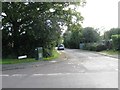
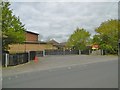
2
Entrance to Lytchett Matravers Primary School
Image: © Alex McGregor
Taken: 24 Sep 2015
0.16 miles
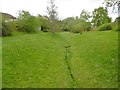
3
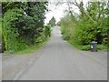
Lytchett Matravers, Deans Drove
Village road with a hollow (caused or used by Image) from Foxhills Road to Wareham Road.
Image: © Mike Faherty
Taken: 17 Apr 2017
0.17 miles
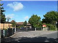
4
Lytchett Matravers Primary School, Dorset
Originally opened in 1874, the school moved to its present site in 1992. The last Ofsted inspection identified it as a 'very good school'.
Image: © John Lamper
Taken: 20 Nov 2005
0.17 miles
5
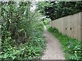
Lytchett Matravers, footpath
From Deans Drove, following the course of Image
Image: © Mike Faherty
Taken: 17 Apr 2017
0.17 miles
6
Lytchett Matravers Primary School
On Wareham Road: http://www.lytchettmatraversprimary.org.uk/
Image: © Mike Faherty
Taken: 17 Apr 2017
0.19 miles
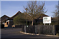
7
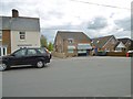
Lytchett Matravers, store
General store and family butchers, on Wareham Road.
Image: © Mike Faherty
Taken: 17 Apr 2017
0.19 miles
8
Lytchett Matravers, brook
Originating from a spring nearby, flowing down to join Sherford River.
Image: © Mike Faherty
Taken: 17 Apr 2017
0.23 miles