
IMAGES TAKEN NEAR TO
Spy Close, POOLE, BH16 6DQ
Introduction
This page details the photographs taken nearby to Spy Close, BH16 6DQ by members of the Geograph project.
The Geograph project started in 2005 with the aim of publishing, organising and preserving representative images for every square kilometre of Great Britain, Ireland and the Isle of Man.

There are currently over 7.5m images from over14,400 individuals and you can help contribute to the project by visiting https://www.geograph.org.uk
Image Map
Images are licensed for reuse under creativecommons.org/licenses/by-sa/2.0
Notes
- Clicking on the map will re-center to the selected point.
- The higher the marker number, the further away the image location is from the centre of the postcode.
Image Listing (18 Images Found)
Images are licensed for reuse under creativecommons.org/licenses/by-sa/2.0
Image
Details
Distance
1
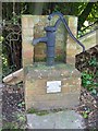
Village pump, Lytchett Matravers
The village pump was restored by the Lytchett Matravers Women's Institute to mark their Diamond Jubilee, November 1980.
Image: © Maigheach-gheal
Taken: 31 Jan 2010
0.07 miles
2
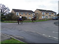
Street scene, Lytchett Matravers
Lychett is a very busy village and it was surprising how many horses and ponies are being ridden along the streets in all directions.
Image: © Maigheach-gheal
Taken: 26 Feb 2011
0.09 miles
3
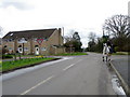
Street scene, Lytchett Matravers
The horse was remarkably good considering the amount of traffic and others things that were going on in streets. There is also a Dorset County Council finger post to the left of the image.
Image: © Maigheach-gheal
Taken: 26 Feb 2011
0.10 miles
4
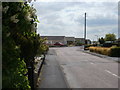
Lytchett Matravers, Old Pound Close
Bungalows off High Street.
Image: © Mike Faherty
Taken: 10 May 2010
0.10 miles
5
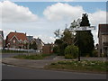
Lytchett Matravers, fingerpost
On High Street, a traditional Dorset fingerpost, with grid reference and location (Lytchett Matravers Higher Cross).
Image: © Mike Faherty
Taken: 10 May 2010
0.11 miles
6
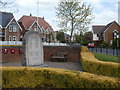
Lytchett Matravers, war memorial
At Higher Cross, on High Street; recording the names of 31 killed in WW1, and 13 in WW2.
Image: © Mike Faherty
Taken: 10 May 2010
0.11 miles
7

Lytchett Matravers: detail of Higher Cross finger-post
A close-up of the finial of the finger-post (see Image), giving location and grid reference details.
Image: © Chris Downer
Taken: 7 Mar 2010
0.11 miles
8
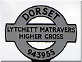
Sign detail, Lytchett Matravers
The detail on the sign in Image
Image: © Maigheach-gheal
Taken: 26 Feb 2011
0.11 miles
9
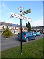
Old Direction Sign - Signpost by High Street, Lytchett Matravers
Annulus and bar finial - 4 arms; Dorset halo with NGR by the UC road, in parish of Lytchett Matravers (Purbeck District), Lytchett Matravers, junction of High Street with Limekiln Road, on verge.
Surveyed
Milestone Society National ID: DO_SY9495A
Image: © Milestone Society
Taken: Unknown
0.11 miles
10
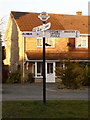
Lytchett Matravers: Higher Cross finger-post
This traditional Dorset signpost retains its original finial, giving location and grid reference details. However, the fingers themselves are modern replacements.
For a close-up of the finial, see Image
Image: © Chris Downer
Taken: 7 Mar 2010
0.12 miles