
IMAGES TAKEN NEAR TO
Ventura Place, POOLE, BH16 5SW
Introduction
This page details the photographs taken nearby to Ventura Place, BH16 5SW by members of the Geograph project.
The Geograph project started in 2005 with the aim of publishing, organising and preserving representative images for every square kilometre of Great Britain, Ireland and the Isle of Man.

There are currently over 7.5m images from over14,400 individuals and you can help contribute to the project by visiting https://www.geograph.org.uk
Image Map
Images are licensed for reuse under creativecommons.org/licenses/by-sa/2.0
Notes
- Clicking on the map will re-center to the selected point.
- The higher the marker number, the further away the image location is from the centre of the postcode.
Image Listing (11 Images Found)
Images are licensed for reuse under creativecommons.org/licenses/by-sa/2.0
Image
Details
Distance
1
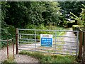
Ropers Lane
This is an old track that runs south from the end of Ropers lane which itself runs south of the Poole Rd just east of Upton. The gate is about 40m south of the northern edge of the grid square.
Image: © Nigel Mykura
Taken: 29 Jul 2010
0.05 miles
2

Ropers Lane
This is an unmade up short residential road on the east side of Upton just south of the Poole Rd. This is the view north from close to the edge of the grid square.
Image: © Nigel Mykura
Taken: 29 Jul 2010
0.12 miles
3

Turf Zone "UptonTrailway"
Former railway line at Upton.
Image: © Ian S
Taken: 17 Nov 2022
0.15 miles
4

Upton : Poole Road
Looking along Poole Road as it heads out from Upton.
Image: © Lewis Clarke
Taken: 28 Oct 2017
0.16 miles
5
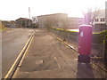
Upton: postbox № BH16 294, Factory Road
This modern postbox serves Upton Industrial Estate and is emptied at 5:30pm on weekdays and at noon on Saturdays.
Image: © Chris Downer
Taken: 15 Nov 2009
0.18 miles
6

Upton : Poole Road Houses
A small access road and homes on Poole Road.
Image: © Lewis Clarke
Taken: 28 Oct 2017
0.19 miles
7
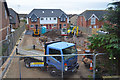
Upton : Construction Site
A small construction site seen off Poole Road.
Image: © Lewis Clarke
Taken: 28 Oct 2017
0.19 miles
8
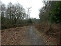
Upton Country Park
Near the western entrance, from Factory Road. http://www.boroughofpoole.com/go.php?structureID=categories&ref=C4648540DEA798
Image: © Mike Faherty
Taken: 28 Feb 2010
0.24 miles
9

Hamworthy, dismantled railway
Overgrown trackbed of the Poole to Wimborne railway ("Castleman's Corkscrew"), closed 1964; the embankments on each side can still be detected. http://homepage.ntlworld.com/ron.strutt/rrcor2.html
Image: © Mike Faherty
Taken: 28 Feb 2010
0.24 miles
10
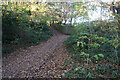
Turf Zone "AllensFactory"
Former railway line at Upton.
Image: © Ian S
Taken: 17 Nov 2022
0.24 miles