
IMAGES TAKEN NEAR TO
Tree Hamlets, POOLE, BH16 5SB
Introduction
This page details the photographs taken nearby to Tree Hamlets, BH16 5SB by members of the Geograph project.
The Geograph project started in 2005 with the aim of publishing, organising and preserving representative images for every square kilometre of Great Britain, Ireland and the Isle of Man.

There are currently over 7.5m images from over14,400 individuals and you can help contribute to the project by visiting https://www.geograph.org.uk
Image Map
Images are licensed for reuse under creativecommons.org/licenses/by-sa/2.0
Notes
- Clicking on the map will re-center to the selected point.
- The higher the marker number, the further away the image location is from the centre of the postcode.
Image Listing (10 Images Found)
Images are licensed for reuse under creativecommons.org/licenses/by-sa/2.0
Image
Details
Distance
1
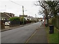
Sandy Lane, Upton, near Poole
Sandy Lane is a minor road in Upton, near Poole. The road is served by buses, as shown by the bus stops either side of the road.
Image: © Malc McDonald
Taken: 6 Feb 2022
0.07 miles
2
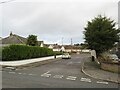
Peters Close, Upton, near Poole
Peters Close is a residential cul-de-sac in Upton, near Poole.
Image: © Malc McDonald
Taken: 6 Feb 2022
0.09 miles
3
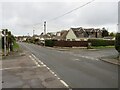
Sandy Lane, Upton, near Poole
Sandy Lane is a residential road in Upton, near Poole.
Image: © Malc McDonald
Taken: 6 Feb 2022
0.13 miles
4
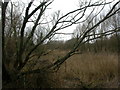
Turlin Moor, wetland
Reed beds and carr on Turlin Moor Nature Reserve. Other habitats on the reserve are scrub and grassland. http://www.poole.gov.uk/facilities/ref:F465e9bc762612/
Image: © Mike Faherty
Taken: 28 Feb 2010
0.19 miles
5
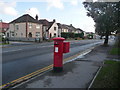
Hamworthy: postbox № BH16 170, Blandford Road
This George V-reign postbox is emptied finally at 5:30pm on weekdays and at 11:45am on Saturdays.
Image: © Chris Downer
Taken: 15 Nov 2009
0.20 miles
6
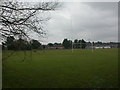
Turlin Moor, rugby pitch
On Turlin Moor Recreation Ground; used by Poole RFC. In the distance, schools on Turlin Road. http://poolerugby.co.uk/
Image: © Mike Faherty
Taken: 28 Feb 2010
0.21 miles
7
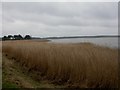
Turlin Moor, Lytchett Bay
One of several bays in Poole Harbour. Much of the coastline locally is covered in reed beds, as here.
Image: © Mike Faherty
Taken: 28 Feb 2010
0.23 miles
8
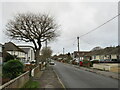
Sandy Lane, Upton, near Poole
Sandy Lane is a minor residential road in Upton, near Poole.
This image was taken on a dull February day. The tree to the left of the road was bare for the winter.
Image: © Malc McDonald
Taken: 6 Feb 2022
0.23 miles
9
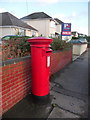
Upton: postbox № BH16 260, Sandy Lane
This Elizabeth II-reign postbox is emptied finally at 5:30pm on weekdays and at 11am on Saturdays.
Image: © Chris Downer
Taken: 15 Nov 2009
0.24 miles
10
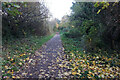
Turf Zone "UptonTrailway"
Former railway line at Upton.
Image: © Ian S
Taken: 17 Nov 2022
0.25 miles