
IMAGES TAKEN NEAR TO
Castlemain Gardens, POOLE, BH16 5FE
Introduction
This page details the photographs taken nearby to Castlemain Gardens, BH16 5FE by members of the Geograph project.
The Geograph project started in 2005 with the aim of publishing, organising and preserving representative images for every square kilometre of Great Britain, Ireland and the Isle of Man.

There are currently over 7.5m images from over14,400 individuals and you can help contribute to the project by visiting https://www.geograph.org.uk
Image Map
Images are licensed for reuse under creativecommons.org/licenses/by-sa/2.0
Notes
- Clicking on the map will re-center to the selected point.
- The higher the marker number, the further away the image location is from the centre of the postcode.
Image Listing (31 Images Found)
Images are licensed for reuse under creativecommons.org/licenses/by-sa/2.0
Image
Details
Distance
1
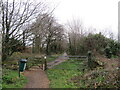
Upton Trailway, near Poole
Upton Trailway is a dismantled railway which is now used as a walking and cycling trail.
This image was taken on a dull February afternoon. Most of the trees were bare for the winter months.
Image: © Malc McDonald
Taken: 6 Feb 2022
0.06 miles
2
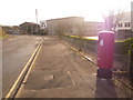
Upton: postbox № BH16 294, Factory Road
This modern postbox serves Upton Industrial Estate and is emptied at 5:30pm on weekdays and at noon on Saturdays.
Image: © Chris Downer
Taken: 15 Nov 2009
0.07 miles
3
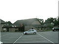
Upton Community Centre
Upton Community Centre is a large venue which can be divided into smaller rooms. The main hall can seat 300 people and boasts a stage with lighting.
Bookings on 01202 621574
Suitable for Parties, Gigs, plays, meetings, clubs
Image: © Mr Simon F B Thomson
Taken: 7 May 2007
0.07 miles
4
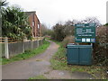
Upton Trailway, near Poole
Upton Trailway is a former railway route, now used as a cycling and walking path, at Upton near Poole.
Image: © Malc McDonald
Taken: 6 Feb 2022
0.07 miles
5
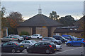
Upton : St Dunstan's Church
Looking towards the church on Poole Road.
Image: © Lewis Clarke
Taken: 28 Oct 2017
0.09 miles
6
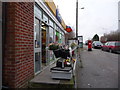
Upton: post office and postbox № BH16 36, Poole Road
The post office is set within a Spar convenience store, and has outside it a large, George VI-reign postbox which is emptied finally at 5:30pm on weekdays and at 12:15pm on Saturdays.
Image: © Chris Downer
Taken: 17 Jan 2009
0.10 miles
7
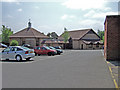
St Dunstan's Church & Community Centre - Upton
Image: © Mike Searle
Taken: 4 May 2007
0.10 miles
8
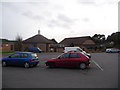
Upton: St. Dunstan?s church
A Church of England church in the village centre, also encompassing the village community centre.
Image: © Chris Downer
Taken: 17 Jan 2009
0.10 miles
9
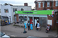
Upton : The Co-Operative Food
A convenience store located on Poole Road.
Image: © Lewis Clarke
Taken: 28 Oct 2017
0.10 miles
10
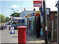
The Upton Garage & Post Office - Upton
Looking east along Poole Road.
Image: © Mike Searle
Taken: 4 May 2007
0.10 miles