
IMAGES TAKEN NEAR TO
Egmont Road, POOLE, BH16 5AR
Introduction
This page details the photographs taken nearby to Egmont Road, BH16 5AR by members of the Geograph project.
The Geograph project started in 2005 with the aim of publishing, organising and preserving representative images for every square kilometre of Great Britain, Ireland and the Isle of Man.

There are currently over 7.5m images from over14,400 individuals and you can help contribute to the project by visiting https://www.geograph.org.uk
Image Map
Images are licensed for reuse under creativecommons.org/licenses/by-sa/2.0
Notes
- Clicking on the map will re-center to the selected point.
- The higher the marker number, the further away the image location is from the centre of the postcode.
Image Listing (14 Images Found)
Images are licensed for reuse under creativecommons.org/licenses/by-sa/2.0
Image
Details
Distance
1
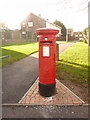
Hamworthy: postbox № BH16 321, Egmont Road
This Elizabeth II-reign postbox is emptied finally at 5:30pm on weekdays and at 11:30am on Saturdays.
It appears that vandals have fed it with some kind of rice takeaway meal, so I'm sure its next collection will be an unpleasant experience for the postman.
Image: © Chris Downer
Taken: 15 Nov 2009
0.08 miles
2
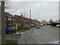
Turlin Moor, Egmont Road
Egmont Road, with ex-council housing built in the 1960s.
Image: © Mike Faherty
Taken: 11 Mar 2010
0.11 miles
3
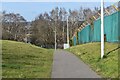
Path towards railway bridge and Turlin Moor
Image: © David Martin
Taken: 26 Feb 2022
0.13 miles
4
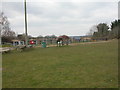
Turlin Moor, play area
Foreland Road Play Area, overlooking the nature reserve. http://www.leisureprojects.net/Playbuilder/foreland.htm
Image: © Mike Faherty
Taken: 11 Mar 2010
0.16 miles
5
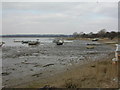
Turlin Moor, moorings
As seen at ebb-tide on the western side of Lytchett Bay.
Image: © Mike Faherty
Taken: 11 Mar 2010
0.17 miles
6
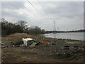
Turlin Moor, power lines
On the western side of Turlin Moor, with Rockley Viaduct just visible to the left in middle distance. This power line appears to be part of that from Hamworthy to Holton Heath, through the middle of Lytchett Bay. This land/water scene would be more attractive without the dumped furniture and rubbish.
Image: © Mike Faherty
Taken: 11 Mar 2010
0.20 miles
7
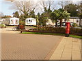
Hamworthy: postbox № BH15 144, Rockley Sands
This Elizabeth II-reign postbox faces the entrance of the main buildings of the Rockley Sands caravan and holiday park. It is emptied finally at 5:30pm on weekdays and at 12:30pm on Saturdays.
Image: © Chris Downer
Taken: 15 Nov 2009
0.23 miles
8
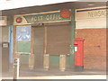
Hamworthy: postbox № BH16 264, Turlin Road
This Elizabeth II-reign postbox stands outside Image and is emptied finally at 5:30pm on weekdays and at 11:30am on Saturdays. The post office has recently relocated to the convenience store at the end of the parade.
Image: © Chris Downer
Taken: 15 Nov 2009
0.24 miles
9
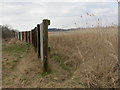
Turlin Moor, bird hide
On the northern side of the nature reserve, giving excellent views over the adjacent reedbeds.
Image: © Mike Faherty
Taken: 11 Mar 2010
0.24 miles
10
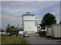
Rockley Park, waterchute
On the holiday park. http://www.haven.com/parks/dorset/rockley_park/onthepark/familywaterfun.aspx
Image: © Mike Faherty
Taken: 31 May 2010
0.24 miles