
IMAGES TAKEN NEAR TO
Victoria Road, BOURNEMOUTH, BH1 4RS
Introduction
This page details the photographs taken nearby to Victoria Road, BH1 4RS by members of the Geograph project.
The Geograph project started in 2005 with the aim of publishing, organising and preserving representative images for every square kilometre of Great Britain, Ireland and the Isle of Man.

There are currently over 7.5m images from over14,400 individuals and you can help contribute to the project by visiting https://www.geograph.org.uk
Image Map
Images are licensed for reuse under creativecommons.org/licenses/by-sa/2.0
Notes
- Clicking on the map will re-center to the selected point.
- The higher the marker number, the further away the image location is from the centre of the postcode.
Image Listing (156 Images Found)
Images are licensed for reuse under creativecommons.org/licenses/by-sa/2.0
Image
Details
Distance
1
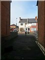
Springbourne: arriving on Victoria Road from footpath D04
This public footpath runs between two parallel residential streets, Spring Road being behind us and Victoria Road here in front of us.
See Image for the view towards us from across the road ahead, and Image for the next view on the path behind us.
Image: © Chris Downer
Taken: 16 Feb 2017
0.02 miles
2
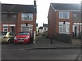
Springbourne: footpath D04 from Victoria Road
This public footpath runs from Victoria Road to the next parallel street, Spring Road.
See Image for the next view on the path.
Image: © Chris Downer
Taken: 16 Feb 2017
0.02 miles
4
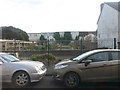
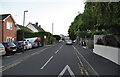
Springbourne: Elizabeth Gardens Allotments
A small council-run plot of allotments in Victoria Road. The name Elizabeth Gardens does not seem to refer to any larger entity as the allotments take up the whole of the grounds here.
Image: © Chris Downer
Taken: 16 Feb 2017
0.03 miles
6
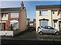
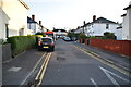
Springbourne: footpath D04 from Spring Road
A wide-ish cut-through between two parallel residential streets, Spring and Victoria Roads.
See Image for the next in a series of photos along the path.
Image: © Chris Downer
Taken: 16 Feb 2017
0.03 miles
8
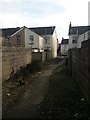
Springbourne: concrete segment on footpath D04
This public footpath runs between Spring (ahead) and Victoria Roads and is mainly tarmacked. However, this short central section has been concreted.
To the left and right just ahead, a narrow path leads to the back gardens of both streets.
See Image for the view towards us from Spring Road ahead, and Image for the next view on the path behind us.
Image: © Chris Downer
Taken: 16 Feb 2017
0.04 miles
9
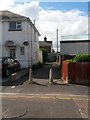
Springbourne: footpath D06 from Cleveland Gardens
A public footpath runs ahead of us, then left behind the houses to join a rear driveway, then right to meet the main Holdenhurst Road.
See Image for the next photo along the path.
Image: © Chris Downer
Taken: 1 Jul 2016
0.04 miles
10
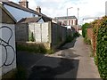
Springbourne: footpath D06 is ahead and left
Looking along a rear access driveway behind the shops of Holdenhurst Road. The public footpath from Cleveland Gardens (ahead) turns to meet Holdenhurst Road, off to the left of the picture.
See Image for the view towards us from by the lamppost, and Image for the path to the left.
Image: © Chris Downer
Taken: 1 Jul 2016
0.04 miles