
IMAGES TAKEN NEAR TO
Hevalo Close, BOURNEMOUTH, BH1 4DG
Introduction
This page details the photographs taken nearby to Hevalo Close, BH1 4DG by members of the Geograph project.
The Geograph project started in 2005 with the aim of publishing, organising and preserving representative images for every square kilometre of Great Britain, Ireland and the Isle of Man.

There are currently over 7.5m images from over14,400 individuals and you can help contribute to the project by visiting https://www.geograph.org.uk
Image Map
Images are licensed for reuse under creativecommons.org/licenses/by-sa/2.0
Notes
- Clicking on the map will re-center to the selected point.
- The higher the marker number, the further away the image location is from the centre of the postcode.
Image Listing (246 Images Found)
Images are licensed for reuse under creativecommons.org/licenses/by-sa/2.0
Image
Details
Distance
1
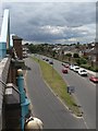
Boscombe: Centenary Way
This road was put in when the main Christchurch Road in central Boscombe was pedestrianised, and the Sovereign shopping centre built, in 1990. It is named after the fact that that year marked the 100th anniversary of Bournemouth becoming a town. Here, we are looking from the top level of the Sovereign Centre car park.
On the right, we see a wall shielding the heavy traffic from Gladstone Road West, whose southern properties were sacrificed for this new-look Boscombe centre.
Image: © Chris Downer
Taken: 12 Jul 2008
0.04 miles
2
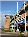
Boscombe: Sovereign Centre car park entrance
The vehicular entrance to the shopping centre car park, on Image
Image: © Chris Downer
Taken: 13 Jul 2008
0.06 miles
3
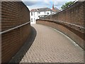
Boscombe: emerging onto Ashley Road
This subway links Ashley Road (ahead of us) with the Sovereign shopping centre and Image, taking pedestrians safely under the busy Image
Image: © Chris Downer
Taken: 12 Jul 2008
0.06 miles
4
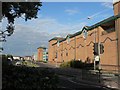
Boscombe: Sovereign car park fa?ade
Looking east along Image with the Sovereign Centre car park alongside.
Image: © Chris Downer
Taken: 13 Jul 2008
0.06 miles
5
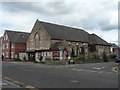
Boscombe: Baptist church
Boscombe's Baptist church is in Palmerston Road, on the corner of Gladstone Road West.
Image: © Chris Downer
Taken: 12 Jul 2008
0.07 miles
6
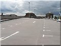
Boscombe: Sovereign Centre car park ? roof level
The top level of the Image car park. The lumpiness of this side is due to the entrance/exit ramps emerging on the far side from the floor below.
Image: © Chris Downer
Taken: 12 Jul 2008
0.07 miles
8
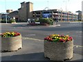
Boscombe: Christchurch Road Roundabout
A bit of a misnomer this, as it is actually not on Christchurch Road. It is at the junction of Ashley Road and Image, which latter road bypassed the main Christchurch Road when the nearby part was pedestrianised in 1990. See also Image
In the background is Image
Image: © Chris Downer
Taken: 13 Jul 2008
0.08 miles
9
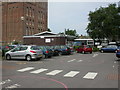
Boscombe & Springbourne Health Centre
Brand new centre (opened today), in the shadows of Image and next to NHS offices. A walk-in centre, open 12 hours a day and 365 days a year. http://www.nwic.org.uk/
Image: © Mike Faherty
Taken: 1 Jul 2009
0.08 miles
10
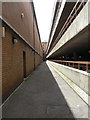
Boscombe: Sovereign Centre fire exit alley
This alleyway runs between the back of the Image centre and its car park. The fire exits from shops on this side of the centre lead onto this alley – they are the doors along the left-hand side.
Image: © Chris Downer
Taken: 12 Jul 2008
0.08 miles