
IMAGES TAKEN NEAR TO
Ringwood Road, POOLE, BH14 0RS
Introduction
This page details the photographs taken nearby to Ringwood Road, BH14 0RS by members of the Geograph project.
The Geograph project started in 2005 with the aim of publishing, organising and preserving representative images for every square kilometre of Great Britain, Ireland and the Isle of Man.

There are currently over 7.5m images from over14,400 individuals and you can help contribute to the project by visiting https://www.geograph.org.uk
Image Map
Images are licensed for reuse under creativecommons.org/licenses/by-sa/2.0
Notes
- Clicking on the map will re-center to the selected point.
- The higher the marker number, the further away the image location is from the centre of the postcode.
Image Listing (13 Images Found)
Images are licensed for reuse under creativecommons.org/licenses/by-sa/2.0
Image
Details
Distance
1
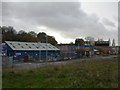
Foxholes, industrial estate
Kinson Pottery Industrial Estate, off Ringwood Road, built on the site of the pottery, which closed in the 1970s.
Image: © Mike Faherty
Taken: 22 Nov 2009
0.03 miles
2
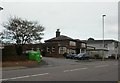
Foxholes, The Pottery
Friendly unreconstructed pub on Ringwood Road, named after Kinson Pottery, which was located opposite until the 1970s. Internally, long bar at the rear, with three drinking areas to the front; pool, darts and a piano. Cask ale on offer at my visit: Ringwood Best.
Image: © Mike Faherty
Taken: 22 Nov 2009
0.05 miles
3
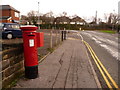
Oakdale: postbox № BH15 25, Dale Road
An Elizabeth II-reign postbox, emptied on weekdays at 5:30pm and on Saturdays at 1pm.
Image: © Chris Downer
Taken: 28 Dec 2009
0.09 miles
4

Parkstone, footpath
Wooded footpath between the eastern and western ends of Parkstone Heights.
Image: © Mike Faherty
Taken: 21 Nov 2009
0.17 miles
5
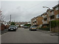
Foxholes, Haymoor Road
Mixed modern housing - bungalows, flats and houses.
Image: © Mike Faherty
Taken: 22 Nov 2009
0.19 miles
6

Parkstone Heights
Mixed age and style housing in the eastern section of Parkstone Heights, joined to the western by a steep footpath Image
Image: © Mike Faherty
Taken: 21 Nov 2009
0.19 miles
7

Parkstone, The Topiary
Modern apartment blocks off the southern end of Parkstone Heights.
Image: © Mike Faherty
Taken: 21 Nov 2009
0.20 miles
8
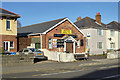
Newtown Liberal Hall
Housing Dance Majic, giving dancing lessons.
Image: © Robin Webster
Taken: 25 Nov 2016
0.21 miles
9
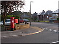
Newtown: postbox № BH15 80, Hamble Road
This box is on the corner of Foxholes Road, down which we are looking, and receives its final collection at 5:30pm on weekdays and at 1pm on Saturdays.
Image: © Chris Downer
Taken: 29 Jun 2009
0.21 miles
10
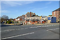
Building work, Poole
On the corner of Dale Valley Road and Foxholes Road.
Image: © Robin Webster
Taken: 25 Nov 2016
0.22 miles