
IMAGES TAKEN NEAR TO
Canford Cliffs Road, POOLE, BH13 7AA
Introduction
This page details the photographs taken nearby to Canford Cliffs Road, BH13 7AA by members of the Geograph project.
The Geograph project started in 2005 with the aim of publishing, organising and preserving representative images for every square kilometre of Great Britain, Ireland and the Isle of Man.

There are currently over 7.5m images from over14,400 individuals and you can help contribute to the project by visiting https://www.geograph.org.uk
Image Map
Images are licensed for reuse under creativecommons.org/licenses/by-sa/2.0
Notes
- Clicking on the map will re-center to the selected point.
- The higher the marker number, the further away the image location is from the centre of the postcode.
Image Listing (18 Images Found)
Images are licensed for reuse under creativecommons.org/licenses/by-sa/2.0
Image
Details
Distance
1
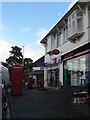
Parkstone: Penn Hill Avenue Post Office
This post office, within Balfour News, is one of the 2,500 casualties of the 2008 round of closures, its last day of service being Wednesday 29 October. It will have served the locality for 82 years when it shuts for the last time.
There is a slight optical illusion looking from this angle, as the canopy of the neighbour is superimposed precisely on the signboard of the newsagent.
Image: © Chris Downer
Taken: 27 Oct 2008
0.11 miles
2

Parkstone: postbox № BH14 68, Penn Hill Avenue
This postbox stands outside Image I suspect the post office direction sign will be removed shortly, owing to the office's permanent closure.
Image: © Chris Downer
Taken: 27 Oct 2008
0.12 miles
3
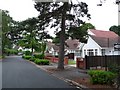
Bulnois Avenue
This quiet residential road with perfectly manicured houses that look almost unreal runs west from Canford Cliffs Road to Kings Avenue.
Image: © Nigel Mykura
Taken: 13 Jul 2010
0.13 miles
5
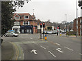
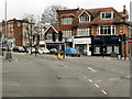
Leicester Road/Penn Hill Avenue Junction, Branksome
Image: © David Dixon
Taken: 1 Apr 2013
0.15 miles
6
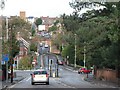
Parkstone: Penn Hill and Archway Road
Looking down the northern end of Canford Cliffs Road, towards the five-way junction called Penn Hill. Looking beyond, it is easy to see how Archway Road gets its name, the main London to Weymouth railway line crossing it just before the ascent to Bournemouth Road.
Image: © Chris Downer
Taken: 27 Oct 2008
0.17 miles
7
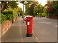
Parkstone: postbox № BH14 128, King?s Avenue
A George V-reign postbox whose advertised last collection times are 5:30pm on weekdays and noon on Saturdays.
Image: © Chris Downer
Taken: 9 Aug 2009
0.18 miles
8
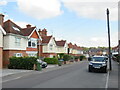
Parkstone Avenue, Penn Hill, Poole
Parkstone Avenue is a residential road in Penn Hill, a suburb of Poole.
Image: © Malc McDonald
Taken: 25 Aug 2021
0.20 miles
9
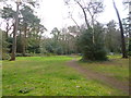
Branksome Park Woods
Linear gardens following the course of a brook, and, to the South, Branksome Chine, finishing at the sea at Pinecliff Road.
Image: © Mike Faherty
Taken: 26 Mar 2014
0.20 miles
10
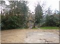
Branksome Park Woods, gateway
Formerly at the entrance to Branksome Towers, re-erected here in 1990; known as "County Gates" because of its former position at the boundary of Hampshire and Dorset.
Image: © Mike Faherty
Taken: 26 Mar 2014
0.20 miles