IMAGES TAKEN NEAR TO
Balcombe Road, POOLE, BH13 6DY
Introduction
This page details the photographs taken nearby to Balcombe Road, BH13 6DY by members of the Geograph project.
The Geograph project started in 2005 with the aim of publishing, organising and preserving representative images for every square kilometre of Great Britain, Ireland and the Isle of Man.

There are currently over 7.5m images from over14,400 individuals and you can help contribute to the project by visiting https://www.geograph.org.uk
Image Map
Images are licensed for reuse under creativecommons.org/licenses/by-sa/2.0
Notes
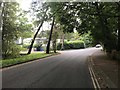
- Clicking on the map will re-center to the selected point.
- The higher the marker number, the further away the image location is from the centre of the postcode.
Image Listing (18 Images Found)
Images are licensed for reuse under creativecommons.org/licenses/by-sa/2.0
Image
Details
Distance
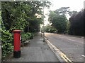
2
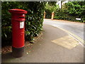
Branksome: postbox № BH13 50, Wilderton Road
This Victorian postbox is emptied finally at 5:30pm on weekdays and at 12:30pm on Saturdays.
Image: © Chris Downer
Taken: 3 Aug 2009
0.11 miles
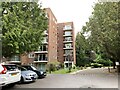
3
New development in Branksome Park
No.5 Burton Road is a new development of 2 and 3 bedroom apartments. The show apartment is due to be unveiled just a week after this photo was taken.
Image: © Jonathan Hutchins
Taken: 28 May 2018
0.15 miles
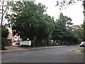
6
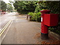
Branksome: postbox № BH13 136, Lindsay Road
A nice example of an Edward VII-reign postbox, on the corner of Burton Road, emptied finally at 5:30pm on weekdays and at 12:30pm on Saturdays.
Beyond, we see one corner of the busy County Gates Gyratory, named for the fact that until 1974 it was alongside the Hampshire-Dorset boundary. The Poole-Bournemouth borough boundary is still there.
Image: © Chris Downer
Taken: 3 Aug 2009
0.19 miles
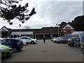
8
Flats and visitor parking, Burton Road, Poole
Image: © Jonathan Hutchins
Taken: 28 Apr 2019
0.20 miles
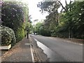
9
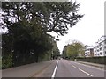
Lindsay Road, Branksome
This runs parallel to the busy A35, but access between the two is difficult so this residential road is much quieter
Image: © David Smith
Taken: 30 Mar 2017
0.20 miles
10
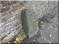
Old Boundary Marker on the A35 in Poole
Parish Boundary Marker against a brick wall on the south side of the A35 Poole Road, Poole. On the former boundary of Parkstone and Kinson parishes.
Milestone Society National ID: DO_PO03pb
Image: © M Faherty
Taken: 19 Oct 2006
0.21 miles