
IMAGES TAKEN NEAR TO
Vine Farm Road, POOLE, BH12 5EN
Introduction
This page details the photographs taken nearby to Vine Farm Road, BH12 5EN by members of the Geograph project.
The Geograph project started in 2005 with the aim of publishing, organising and preserving representative images for every square kilometre of Great Britain, Ireland and the Isle of Man.

There are currently over 7.5m images from over14,400 individuals and you can help contribute to the project by visiting https://www.geograph.org.uk
Image Map
Images are licensed for reuse under creativecommons.org/licenses/by-sa/2.0
Notes
- Clicking on the map will re-center to the selected point.
- The higher the marker number, the further away the image location is from the centre of the postcode.
Image Listing (84 Images Found)
Images are licensed for reuse under creativecommons.org/licenses/by-sa/2.0
Image
Details
Distance
2
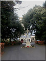
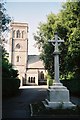
Talbot Village, war memorial
On the drive leading to St Mark's Church, seen in the background Image 43 names from the First World War are recorded.
Image: © Mike Faherty
Taken: 4 Jan 2009
0.11 miles
3

Talbot Village: postbox № BH10 19, Wallisdown Road
This Victorian postbox, mounted in a brick-built pillar, is at the older part of Talbot Village, and has a rather damaged hood.
Image: © Chris Downer
Taken: 6 Jul 2008
0.12 miles
4
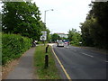
Bournemouth : Wallisdown Road
Approaching University Roundabout.
Image: © Lewis Clarke
Taken: 20 May 2009
0.13 miles
5
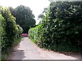
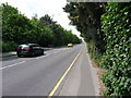
Talbot Village: footpath N38 reaches Wallisdown Road
A red car travels westbound along the perpetually busy Wallisdown Road, as we look along the end of a driveway which doubles as a public footpath from the centre of the village.
See Image for the next view behind us along the route.
Image: © Chris Downer
Taken: 9 Jul 2016
0.13 miles
6
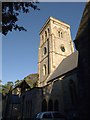
St. Mark's church, Talbot Village
So close is the church to the northing gridline that it cannot realistically be photographed from the south (the sunny side) without stepping into Image It dates from 1868-70 and is built of Purbeck stone. "Tall 4-stage tower of Somerset Perpendicular outline but Early English detail: 2 light belfry window (plate tracery) flanked by 2 blind lancets, clock face in arched triangle below on south and east" http://www.imagesofengland.org.uk/Details/Default.aspx?id=101881&mode=adv . See also Image and Image
Image: © Derek Harper
Taken: 12 Oct 2009
0.13 miles
9
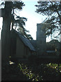
Talbot Village, St Mark's Church
English Heritage-listed church in Talbot Village Image, finished in 1870; built by the village's founder, Georgina Talbot, who is buried in the churchyard Image For more information, see http://www.imagesofengland.org.uk/Details/Default.aspx?id=101881&mode=adv
Image: © Mike Faherty
Taken: 6 Jan 2009
0.14 miles
10
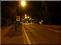
Bournemouth : Wallisdown Road
From the road taken at 9pm heading towards University Roundabout.
Image: © Lewis Clarke
Taken: 8 Mar 2010
0.14 miles