
IMAGES TAKEN NEAR TO
Short Close, POOLE, BH12 5DX
Introduction
This page details the photographs taken nearby to Short Close, BH12 5DX by members of the Geograph project.
The Geograph project started in 2005 with the aim of publishing, organising and preserving representative images for every square kilometre of Great Britain, Ireland and the Isle of Man.

There are currently over 7.5m images from over14,400 individuals and you can help contribute to the project by visiting https://www.geograph.org.uk
Image Map
Images are licensed for reuse under creativecommons.org/licenses/by-sa/2.0
Notes
- Clicking on the map will re-center to the selected point.
- The higher the marker number, the further away the image location is from the centre of the postcode.
Image Listing (35 Images Found)
Images are licensed for reuse under creativecommons.org/licenses/by-sa/2.0
Image
Details
Distance
1
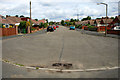
Turning circle at the end of Astbury Avenue
On the northern edge of Poole.
Image: © David Lally
Taken: 30 Jun 2010
0.08 miles
3
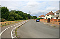
South Park Road
The Bourne Stream runs through the trees and bushes on the left.
Image: © David Lally
Taken: 30 Jun 2010
0.12 miles
4
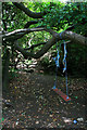
Improvised swing
By the Bourne Stream at Bourne Bottom.
Image: © David Lally
Taken: 30 Jun 2010
0.12 miles
5
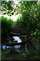
Improvised crossing-point
Various branches and bits of masonry arranged allowing one to cross the Bourne Stream.
Image: © David Lally
Taken: 30 Jun 2010
0.12 miles
7
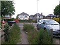
Wallisdown: southern end of footpath U15
This public footpath arrives on the main A3049, Wallisdown Road, from Bascott Close. The frontage line this side of the pavement marks the Bournemouth/Poole borough boundary, meaning that the road and the houses opposite are in Poole, while the houses this side are in Bournemouth.
See Image for the next view on the path behind, with links to further photos along this path and the continuation of it as path U16 to Canford Avenue.
Image: © Chris Downer
Taken: 12 Jul 2016
0.16 miles
8
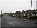
Bloxworth Road
1960s bungalows in Rossmore.
Image: © Burgess Von Thunen
Taken: 10 Nov 2011
0.16 miles
9
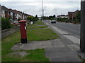
Wallisdown: postbox № BH12 314, Wallisdown Road
This postbox is on the busy A3049 Wallisdown Road; it has its own little paved path across the grass.
Image: © Chris Downer
Taken: 17 Aug 2008
0.17 miles
10
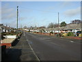
Rossmore, Bloxworth Road
Roads in the North of this square comprise almost all bungalows. Roads are named after Dorset towns and villages; this road is bounded to the North by Image
Image: © Mike Faherty
Taken: 24 Feb 2010
0.17 miles