
IMAGES TAKEN NEAR TO
Farwell Road, POOLE, BH12 4PN
Introduction
This page details the photographs taken nearby to Farwell Road, BH12 4PN by members of the Geograph project.
The Geograph project started in 2005 with the aim of publishing, organising and preserving representative images for every square kilometre of Great Britain, Ireland and the Isle of Man.

There are currently over 7.5m images from over14,400 individuals and you can help contribute to the project by visiting https://www.geograph.org.uk
Image Map
Images are licensed for reuse under creativecommons.org/licenses/by-sa/2.0
Notes
- Clicking on the map will re-center to the selected point.
- The higher the marker number, the further away the image location is from the centre of the postcode.
Image Listing (28 Images Found)
Images are licensed for reuse under creativecommons.org/licenses/by-sa/2.0
Image
Details
Distance
1
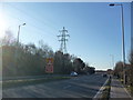
Poole : Canford Way A3049
Canford Way looking towards the Canford Heath.
Image: © Lewis Clarke
Taken: 8 Mar 2010
0.07 miles
2
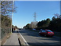
Poole : Canford Way A3049
Canford Way which is on the way to Bournemouth and Ringwood Road.
Image: © Lewis Clarke
Taken: 8 Mar 2010
0.09 miles
3

Alderney, playground
At the end of Farwell Road.
Image: © Mike Faherty
Taken: 6 Jun 2010
0.11 miles
4
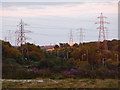
Canford Heath: dual-carriageway wires and lights
Two rows of lampposts – lining the side of the dual-carriageway A3049, unseen in the dip – are themselves flanked by two electricity transmission lines on the southern edge of Canford Heath.
Image: © Chris Downer
Taken: 9 Jul 2009
0.12 miles
5
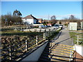
Poole : Bedford Road North
Taken from Canford Way towards Bedford Road North, and a footpath near it.
Image: © Lewis Clarke
Taken: 8 Mar 2010
0.12 miles
6
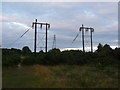
Canford Heath: redundant transmission poles
No wires hang from these wooden poles any more, but there is no shortage of alternatives if cables are your thing – the line in the background and two behind us.
Image: © Chris Downer
Taken: 9 Jul 2009
0.15 miles
7

Alderney Substation
On the bridleway from Francis Avenue.
Image: © Mike Faherty
Taken: 6 Jun 2010
0.15 miles
8
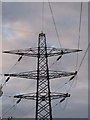
Canford Heath: change in direction of wires
These electricity cables take surprisingly divergent paths south (or do they converge northward?) from this pylon – the map hints at the reason but the following image makes clear what's happening: Image
Image: © Chris Downer
Taken: 9 Jul 2009
0.16 miles
10
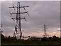
Canford Heath: diverging cables
The cables run from the foreground pylon in different directions, those on each side being carried onto lower pylons to take them under another line before continuing in different directions into town. In the distance, other power lines can be seen, complicating the map.
Image: © Chris Downer
Taken: 9 Jul 2009
0.16 miles