
IMAGES TAKEN NEAR TO
Evering Avenue, POOLE, BH12 4JF
Introduction
This page details the photographs taken nearby to Evering Avenue, BH12 4JF by members of the Geograph project.
The Geograph project started in 2005 with the aim of publishing, organising and preserving representative images for every square kilometre of Great Britain, Ireland and the Isle of Man.

There are currently over 7.5m images from over14,400 individuals and you can help contribute to the project by visiting https://www.geograph.org.uk
Image Map
Images are licensed for reuse under creativecommons.org/licenses/by-sa/2.0
Notes
- Clicking on the map will re-center to the selected point.
- The higher the marker number, the further away the image location is from the centre of the postcode.
Image Listing (11 Images Found)
Images are licensed for reuse under creativecommons.org/licenses/by-sa/2.0
Image
Details
Distance
1

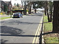
Alderney: postbox № BH12 232, Evering Avenue
An Elizabeth II-reign postbox, emptied finally at 5:30pm on weekdays and at 12:15pm on Saturdays.
Image: © Chris Downer
Taken: 29 Jun 2009
0.04 miles
4
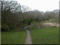
Bourne Valley Park, boardwalk
Boardwalk allowing walkers to negotiate the stream without getting too muddy. http://www.bournestreampartnership.org.uk/alderney_recreation_ground.htm
Image: © Mike Faherty
Taken: 7 Mar 2009
0.14 miles
5
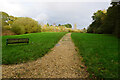
Turf Zone "ValleyTurf"
At Bourne Valley Park.
Image: © Ian S
Taken: 15 Nov 2022
0.16 miles
6
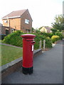
Alderney: postbox № BH12 253, Jersey Road
It is no coincidence that the area of Alderney and Jersey Road are both named after Channel Islands – much of this area is.
The Elizabeth II-reign postbox is emptied finally at 5:15pm on weekdays and at 12:15pm on Saturdays.
Image: © Chris Downer
Taken: 29 Jun 2009
0.18 miles
7
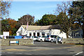
Alderney Manor Community and Social Club
On the corner of Herbert and Berkeley Avenues.
Image: © Robin Webster
Taken: 25 Nov 2016
0.18 miles
8
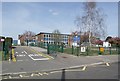
Local School
Situated in Evering Avenue, Alderney.
Image: © mike smith
Taken: 6 Apr 2007
0.21 miles
9
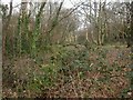
Alderney, Bourne Valley Park
Previously Alderney Recreation Ground, the stream (mainly hidden under brambles above) used to be culverted; in 2006, the stream was exposed, and the open space was made more diverse and attractive. The stream feeds into the Bourne, a kilometre away to the North-East. Seen here, woodland walk, at Herbert Avenue.http://www.bournestreampartnership.org.uk/alderney_recreation_ground.htm
Image: © Mike Faherty
Taken: 7 Mar 2009
0.21 miles
10
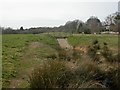
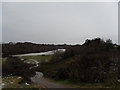
Bourne Valley Park, weir
Bourne Valley Park was remodelled in 2008 to provide a more diverse environment for local residents and to cope with storm water runoffs, with terraced stream channel, basins & weir. For water to pass down the top of the weir was predicted to a be a once in twenty years event; but it happened three times in 2007! http://www.bournestreampartnership.org.uk/alderneyprojectdiary_I.htm#Weir%20Watching,
Image: © Mike Faherty
Taken: 7 Mar 2009
0.24 miles