
IMAGES TAKEN NEAR TO
Melbury Avenue, POOLE, BH12 4EW
Introduction
This page details the photographs taken nearby to Melbury Avenue, BH12 4EW by members of the Geograph project.
The Geograph project started in 2005 with the aim of publishing, organising and preserving representative images for every square kilometre of Great Britain, Ireland and the Isle of Man.

There are currently over 7.5m images from over14,400 individuals and you can help contribute to the project by visiting https://www.geograph.org.uk
Image Map
Images are licensed for reuse under creativecommons.org/licenses/by-sa/2.0
Notes
- Clicking on the map will re-center to the selected point.
- The higher the marker number, the further away the image location is from the centre of the postcode.
Image Listing (13 Images Found)
Images are licensed for reuse under creativecommons.org/licenses/by-sa/2.0
Image
Details
Distance
1
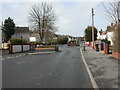
Rossmore, traffic calming
On Arne Avenue; slaloms of brick planters with shrubs.
Image: © Mike Faherty
Taken: 24 Feb 2010
0.06 miles

3
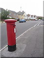
Branksome: postbox № BH12 227, Melbury Avenue
This Elizabeth II-reign postbox serves a medium sized council estate and receives its final collection at 5:30pm on weekdays and at 12:15pm on Saturdays.
Image: © Chris Downer
Taken: 28 Jun 2009
0.13 miles
4
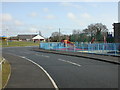
Rossmore, play facility
Arne Avenue Play Facility. On the link photo, it is shown as "play area"; I wonder why the council had to rename it in such an unfriendly manner? http://www.leisureprojects.net/Playbuilder/arneavenue.htm
Image: © Mike Faherty
Taken: 24 Feb 2010
0.15 miles
5
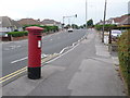
Branksome: postbox № BH12 217, Herbert Avenue
This George VI-reign postbox stands on the busy Herbert Avenue. It is emptied finally at 5:30pm on weekdays and at 12:15pm on Saturdays.
Image: © Chris Downer
Taken: 28 Jun 2009
0.16 miles
6
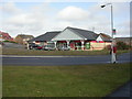
Rossmore, shopping parade
Small parade at the junction of Arne and Melbury Avenues; currently comprising convenience store, take-away, vacant and fish & chip shop.
Image: © Mike Faherty
Taken: 24 Feb 2010
0.18 miles
7
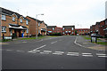
SZ057933: Cashmoor Close
Looking into the housing estate on Cashmoor Close. Picture taken from Aspen Road.
Image: © Kris
Taken: 6 May 2006
0.19 miles
8

Houses on Northmere Rd
These modern and not particularly attractive terraced houses are on Northmere Rd just south of its junction with Northmere Avenue.
Image: © Nigel Mykura
Taken: 7 Feb 2019
0.19 miles
9
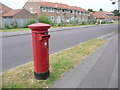
Branksome: postbox № BH12 103, Aspen Gardens
This postbox is currently missing its information plate; indeed missing the border that would keep it in place. The little sticker is one of those that were affixed in autumn 2007 explaining that Sunday collections would cease from 27 October that year (these were put on every box since the majority that did not have Sunday collections had details of the nearest that did) – so presumably the plate has been missing at least since then.
Image: © Chris Downer
Taken: 28 Jun 2009
0.21 miles
10
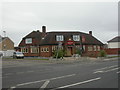
Rossmore, New Star
1930s-looking pub at the junction of Herbert Avenue & Rossmore Road. Rectangular central bar with 3 separate drinking areas. Cask ales on offer at my visit: Ringwood Best & Forty Niner. For some customer reviews, see http://www.beerintheevening.com/pubs/s/28/2849/New_Star_Inn/Branksome
Image: © Mike Faherty
Taken: 7 Mar 2009
0.22 miles