
IMAGES TAKEN NEAR TO
Binnie Road, POOLE, BH12 2AN
Introduction
This page details the photographs taken nearby to Binnie Road, BH12 2AN by members of the Geograph project.
The Geograph project started in 2005 with the aim of publishing, organising and preserving representative images for every square kilometre of Great Britain, Ireland and the Isle of Man.

There are currently over 7.5m images from over14,400 individuals and you can help contribute to the project by visiting https://www.geograph.org.uk
Image Map
Images are licensed for reuse under creativecommons.org/licenses/by-sa/2.0
Notes
- Clicking on the map will re-center to the selected point.
- The higher the marker number, the further away the image location is from the centre of the postcode.
Image Listing (21 Images Found)
Images are licensed for reuse under creativecommons.org/licenses/by-sa/2.0
Image
Details
Distance
1

Branksome Recreation Ground
Large open space on Alder Road; the site of a bitter dispute between local residents and Poole Town Football Club, which would like to develop part of it for a better home. http://www.bournemouthecho.co.uk/news/4462298.CPRE_joins_the_battle_over_Branksome_Rec/
Image: © Mike Faherty
Taken: 9 Jul 2009
0.08 miles
2
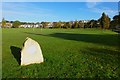
Queen Elizabeth II Field
Recreation ground north of Branksome centre.
Image: © David Lally
Taken: 6 Nov 2016
0.11 miles
3
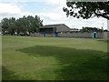
Branksome Rec, pavilion
Pavilion, changing rooms & conveniences at Image
Image: © Mike Faherty
Taken: 9 Jul 2009
0.11 miles
4
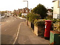
Parkstone: postbox № BH12 153, Davis Road
This Elizabeth II-reign postbox stands by the Gwynne Road turning (just behind us) and is emptied finally at 5:30pm on weekdays and at 12:15pm on Saturdays.
Beyond, we see Library Road crossing the picture, with Layton Road ascending beyond.
Image: © Chris Downer
Taken: 9 Aug 2009
0.12 miles
5
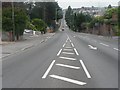
Branksome: Alder Road ? straight down, straight back up
Going south the A3040, Alder Road, runs dead straight, descending a steep hill for the third time before making a third steep ascent. Anyone who has cycled its length will testify to its steepness, lest it should appear deceptively tame in the picture.
Image: © Chris Downer
Taken: 15 Jul 2007
0.13 miles
6

Branksome: postbox № BH12 173, Alder Road
We look from Alder Road along a small cut-through to Sheringham Road, no doubt where traffic would once have been allowed. The box is emptied finally at 5:30pm on weekdays and at 11:30am on Saturdays.
Image: © Chris Downer
Taken: 5 Aug 2009
0.16 miles
7
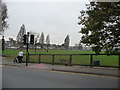
Poole : Branksome Recreation Ground
Bit of a grey day, the leaves are falling, and the road in view is Alder Road.
Image: © Lewis Clarke
Taken: 30 Oct 2009
0.17 miles
8
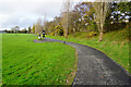
Turf Zone "BranksomeTurf"
In Branksome Recreation Ground.
Image: © Ian S
Taken: 15 Nov 2022
0.17 miles
9
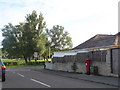
Branksome: postbox № BH12 261, Central Avenue
An Elizabeth II-reign postbox emptied finally at 5:30pm on weekdays and at 12:15pm on Saturdays.
Beyond it, we see across Playfields Drive onto Branksome Recreation Ground.
Image: © Chris Downer
Taken: 5 Aug 2009
0.18 miles
10

Branksome: Runton Road at Christmastime, № 4
Two neighbouring colourful displays in Runton Road, just two of many houses putting on their impressive illuminations.
For other pictures taken here tonight, see http://www.geograph.org.uk/search.php?i=4775002
Image: © Chris Downer
Taken: 1 Jan 2009
0.18 miles