IMAGES TAKEN NEAR TO
Cavendish Road, BOURNEMOUTH, BH1 1RD
Introduction
This page details the photographs taken nearby to Cavendish Road, BH1 1RD by members of the Geograph project.
The Geograph project started in 2005 with the aim of publishing, organising and preserving representative images for every square kilometre of Great Britain, Ireland and the Isle of Man.

There are currently over 7.5m images from over14,400 individuals and you can help contribute to the project by visiting https://www.geograph.org.uk
Image Map
Images are licensed for reuse under creativecommons.org/licenses/by-sa/2.0
Notes
- Clicking on the map will re-center to the selected point.
- The higher the marker number, the further away the image location is from the centre of the postcode.
Image Listing (209 Images Found)
Images are licensed for reuse under creativecommons.org/licenses/by-sa/2.0
Image
Details
Distance
1
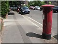
Bournemouth: postbox № BH1 125, Cavendish Road
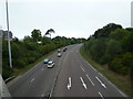
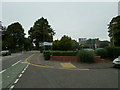
This Edward VII specimen stands on Cavendish Road, a circular road which surrounds Image The cars most likely belong to commuters, this being a rare area of free unlimited roadside parking about a 10-minute walk from the town's business centre.
Image: © Chris Downer
Taken: 26 Jun 2008
0.01 miles
2
Looking across Lansdowne Road towards Lansdowne Gardens
Image: © Basher Eyre
Taken: 20 Aug 2010
0.05 miles
3
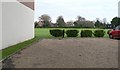
Bournemouth: Dean Park
Dean Park was the home of Hampshire County Cricket Club, jointly with Southampton's County Ground (predecessor to the Rosebowl), until 1992 and is now used by Bournemouth University. One of the stands alongside the pavilion has now been converted into flats – Image – which is the building left of picture. See also Image
It is hard to believe that the 40m contour line could happen to pass around such a small, flat-looking area, but it is clearly marked on the map.
Image: © Chris Downer
Taken: 22 Nov 2007
0.07 miles
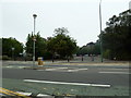
4
Junction of Lansdowne Road and Park Road
Image: © Basher Eyre
Taken: 20 Aug 2010
0.07 miles
5
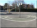
An intriguing cycle lane
This cycle lane looks quite stupid, but in fact it takes cyclists travelling down Lansdowne Road onto the pavement so they can cross to Cavendish Road (in the distance) more easily.
Image: © Chris Downer
Taken: 11 Dec 2007
0.08 miles
7
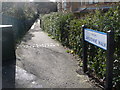
Bournemouth: Lansdowne Walk
A path that runs alongside the town-centre by-pass, leading from Lansdowne Road to the cut-off end of Dean Park Road - severed when the by-pass was put through in 1973. It has only recently had the signage put up - it was previously apparently nameless.
Image: © Chris Downer
Taken: 7 Feb 2014
0.08 miles
9
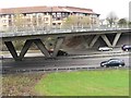
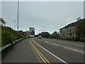
?W W? is for Wessex Way
Two of the three W-shaped supports on the bridge carrying Lansdowne Road over the A338 Wessex Way.
Image: © Chris Downer
Taken: 22 Nov 2007
0.09 miles