IMAGES TAKEN NEAR TO
Runnymede Avenue, BOURNEMOUTH, BH11 9SP
Introduction
This page details the photographs taken nearby to Runnymede Avenue, BH11 9SP by members of the Geograph project.
The Geograph project started in 2005 with the aim of publishing, organising and preserving representative images for every square kilometre of Great Britain, Ireland and the Isle of Man.

There are currently over 7.5m images from over14,400 individuals and you can help contribute to the project by visiting https://www.geograph.org.uk
Image Map (Loading...)


Getting Data...Please wait
Leaflet Map data © OpenStreetMap
Images are licensed for reuse under creativecommons.org/licenses/by-sa/2.0
Notes
- Clicking on the map will re-center to the selected point.
- The higher the marker number, the further away the image location is from the centre of the postcode.
Image Listing (29 Images Found)
Images are licensed for reuse under creativecommons.org/licenses/by-sa/2.0
Image
Details
Distance
2
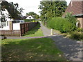
Bearwood, footpath
Footpath between Runnymede Avenue & Magna Road; not recognised as a right of way by OS.
Image: © Mike Faherty
Taken: 24 Aug 2009
0.13 miles
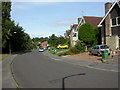
3
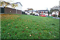
Turf Zone "RunnyNose"
On Runnymede Avenue, Bearwood.
Image: © Ian S
Taken: 15 Nov 2022
0.14 miles
5
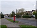
Bearwood: postbox № BH11 397, King John Avenue
This postbox is close to the 'centre' of Bearwood if there is one – by the community centre and supermarket, and outside St. Barnabas' church.
Image: © Chris Downer
Taken: 4 Jan 2009
0.15 miles
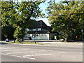
6
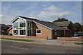
The new St. Barnabas Church, Bearwood
In September 2010 the all new St. Barnabas Church in Bearwood was opened. The Church is now very different from the old one, extended front and back to provide more seating and recreational areas for the growing congregation. Visit http://www.stbarnabasbearwood.org.uk for more information.
Image: © Paul Webster
Taken: 2 Sep 2010
0.16 miles
7
Turf Zone "WellDone"
On Snaplands Avenue, Bearwood.
Image: © Ian S
Taken: 15 Nov 2022
0.16 miles
8
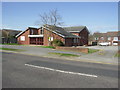
St Barnabas Church
The church was built in the 1980s along with the housing estate.
Image: © mike smith
Taken: 16 Mar 2007
0.16 miles
9
Bearwood, Charter Road
Modern, individualised houses along Charter Road.
Image: © Mike Faherty
Taken: 24 Aug 2009
0.16 miles
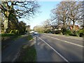
10
Bearwood: post office
Situated on Magna Road, on the corner of Lea Way. This area is geographically in Poole but postally in Bournemouth.
Image: © Chris Downer
Taken: 21 Sep 2008
0.16 miles