
IMAGES TAKEN NEAR TO
Milford Drive, BOURNEMOUTH, BH11 9HL
Introduction
This page details the photographs taken nearby to Milford Drive, BH11 9HL by members of the Geograph project.
The Geograph project started in 2005 with the aim of publishing, organising and preserving representative images for every square kilometre of Great Britain, Ireland and the Isle of Man.

There are currently over 7.5m images from over14,400 individuals and you can help contribute to the project by visiting https://www.geograph.org.uk
Image Map
Images are licensed for reuse under creativecommons.org/licenses/by-sa/2.0
Notes
- Clicking on the map will re-center to the selected point.
- The higher the marker number, the further away the image location is from the centre of the postcode.
Image Listing (72 Images Found)
Images are licensed for reuse under creativecommons.org/licenses/by-sa/2.0
Image
Details
Distance
1
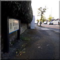
Bear Cross: Benbridge Avenue
Looking along this little road of nice bungalows, from the Exbury Drive end. It turns 90º to the left halfway along.
The sign is a Bournemouth Borough one with the borough coat of arms, dating from around 2000-2006, possibly a little earlier.
This is photo no.33 of a series of 451 in my coronavirus lockdown walking project:
See https://www.geograph.org.uk/article/My-2020-Coronavirus-Lockdown-walking-project for the complete set of photos.
Image: © Chris Downer
Taken: 16 Apr 2020
0.07 miles
2
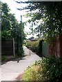
Bear Cross: footpath E01 to Benbridge Avenue
The public footpath from Anchor Road leaves the rear driveway of the shops and heads through this passageway to Benbridge Avenue.
See Image for the view behind us onto the shops' driveway, and Image from the view towards us from the end of the path.
Image: © Chris Downer
Taken: 10 Jul 2016
0.07 miles
3
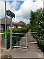
Bear Cross: footpath E01 to Anchor Road
This public footpath leads through to Anchor Road, by the shops. Its first segment is this passageway, and it finishes the journey by taking the rear access driveway for the shops.
See Image for the next view along the path, and further links to other photos along the route.
Image: © Chris Downer
Taken: 10 Jul 2016
0.07 miles
4
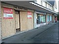
Bear Cross: Anchor Road shopfronts
Presumably the Hobby Horse shop moved from this outlet to the one two doors down, or vice versa, and subsequently closed – giving the impression of two identical shops, neither still trading.
The one with the postbox outside was Anchor Road Post Office until the branch closures of Spring 2004.
See Image for a wider view of the shops.
Image: © Chris Downer
Taken: 9 Feb 2008
0.07 miles
5
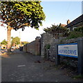
Bear Cross: Milford Drive
Part of the 1950s bungalow development around Bear Cross, we look along Milford Drive past the sign that greets traffic emerging from Exbury Drive, towards its eastern end at Anstey Road. The latter is the boundary of the West Howe council estate, as can be glimpsed by the council semis in the background.
The sign is a modern one, from 2010-15 when this more modern, abstract emblem rather than the traditional town coat of arms as the working logo of the council.
This is photo no.271 of a series of 453 in my coronavirus lockdown walking project:
See https://www.geograph.org.uk/article/My-2020-Coronavirus-Lockdown-walking-project for the complete set of photos.
Image: © Chris Downer
Taken: 16 Apr 2020
0.08 miles
6
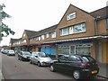
Shopping Parade
This parade of shops is on Anchor Road.
Image: © mike smith
Taken: 20 Jun 2007
0.08 miles
7
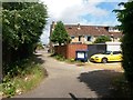
Bear Cross: footpath E01 reaches the shops? rear driveway
The public footpath from Benbridge Avenue approaches its destination of Anchor Road, and this end of the route takes the driveway to the rear of the Anchor Road shopping parade.
See Image for the view towards us from across the road, and Image for the view behind us along the 'proper' footpath.
Image: © Chris Downer
Taken: 10 Jul 2016
0.09 miles
8
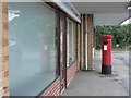
Bear Cross: postbox № BH11 162, Anchor Road
This postbox is reflected in the window of what was Anchor Road Post Office till its closure under a national round of closures in March 2004.
Image: © Chris Downer
Taken: 31 Aug 2008
0.09 miles
9
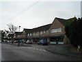
Bear Cross: Anchor Road shops
A parade of increasingly vacant shops. There was a post office here till a round of closures in March 2004.
Image: © Chris Downer
Taken: 31 Aug 2008
0.09 miles
10
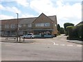
Bear Cross: footpath E01 from Anchor Road
A public footpath heads for Benbridge Avenue from Anchor Road, its first part being up the driveway to the right of Image
See Image for a view back towards the rear access from along the path.
Image: © Chris Downer
Taken: 10 Jul 2016
0.09 miles