
IMAGES TAKEN NEAR TO
Todber Close, BOURNEMOUTH, BH11 8PH
Introduction
This page details the photographs taken nearby to Todber Close, BH11 8PH by members of the Geograph project.
The Geograph project started in 2005 with the aim of publishing, organising and preserving representative images for every square kilometre of Great Britain, Ireland and the Isle of Man.

There are currently over 7.5m images from over14,400 individuals and you can help contribute to the project by visiting https://www.geograph.org.uk
Image Map
Images are licensed for reuse under creativecommons.org/licenses/by-sa/2.0
Notes
- Clicking on the map will re-center to the selected point.
- The higher the marker number, the further away the image location is from the centre of the postcode.
Image Listing (39 Images Found)
Images are licensed for reuse under creativecommons.org/licenses/by-sa/2.0
Image
Details
Distance
2
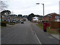
West Howe: postbox № BH11 301, Littlemoor Avenue
Looking along Littlemoor Avenue, which turns right in the distance and follows the borough boundary so that the houses on the back are actually in Poole whereas the rest are in Bournemouth.
Image: © Chris Downer
Taken: 4 Jan 2009
0.10 miles
3
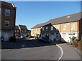
Bournemouth : Stillmore Road
In the suburbs of Bournemouth is this sleepy little road I found while I was out walking.
Image: © Lewis Clarke
Taken: 8 Mar 2010
0.12 miles
4
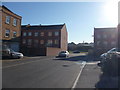
Bournemouth L Stillmore Road
Housing and flats alongside either side of the road. No front gardens as they've been replaced with drives so the roads aren't clogged up.
Image: © Lewis Clarke
Taken: 8 Mar 2010
0.13 miles
5
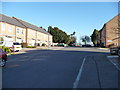
Bournemouth : Stillmore Road
Stillmore Road looking back towards Ringwood Road which from here is only accessible to pedestrians as you have to drive around.
Image: © Lewis Clarke
Taken: 8 Mar 2010
0.13 miles
6
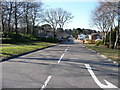
Bournemouth : Littlemore Avenue
A residential road taken from the junction of Ringwood Road.
Image: © Lewis Clarke
Taken: 8 Mar 2010
0.13 miles
7
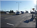
Bournemouth : Ringwood Road A348
Ringwood Road and another pesky speed camera in view.
Image: © Lewis Clarke
Taken: 8 Mar 2010
0.14 miles
8
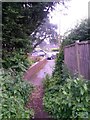
West Howe: footpath U11 to High Howe Close
A very short public footpath, at 13 metres in length, leading to the dead end of one of the offshoots of High Howe Close. This end is a gravel rear-access driveway for Ringwood Road properties.
The extent of the right of way appears to be just the tarmacked part, and not the rough path which leads to it: see Image for a picture from the opposite end.
See Image for a wider view of this approach to the path.
Image: © Chris Downer
Taken: 26 Jun 2016
0.15 miles
9
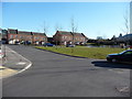
Bournemouth : Stillmore Road
A road from Ringwood Road heading into a housing estate here. A playground and green space is to the right.
Image: © Lewis Clarke
Taken: 8 Mar 2010
0.15 miles
10
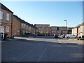
Bournemouth : Stillmore Road
A path connects this area with Ringwood Road, but otherwise cars have to travel a little further along Ringwood Road.
Image: © Lewis Clarke
Taken: 8 Mar 2010
0.15 miles