
IMAGES TAKEN NEAR TO
Weymans Avenue, BOURNEMOUTH, BH10 7JP
Introduction
This page details the photographs taken nearby to Weymans Avenue, BH10 7JP by members of the Geograph project.
The Geograph project started in 2005 with the aim of publishing, organising and preserving representative images for every square kilometre of Great Britain, Ireland and the Isle of Man.

There are currently over 7.5m images from over14,400 individuals and you can help contribute to the project by visiting https://www.geograph.org.uk
Image Map
Images are licensed for reuse under creativecommons.org/licenses/by-sa/2.0
Notes
- Clicking on the map will re-center to the selected point.
- The higher the marker number, the further away the image location is from the centre of the postcode.
Image Listing (72 Images Found)
Images are licensed for reuse under creativecommons.org/licenses/by-sa/2.0
Image
Details
Distance
1
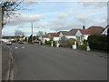
Kinson, bungalows
Bungalows in Weymans Avenue. Note small differences maintaining individual bungalows' individuality.
Image: © Mike Faherty
Taken: 28 Feb 2009
0.02 miles
2
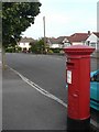
Kinson: postbox № BH10 49, Park Avenue
An Elizabeth II-reign postbox in a residential back-street of Kinson.
Image: © Chris Downer
Taken: 21 Jul 2008
0.03 miles
3
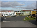
Kinson, Selwood Park
Park home site operated by Berkeley Parks http://www.berkeleyparks.co.uk/
Image: © Mike Faherty
Taken: 28 Feb 2009
0.05 miles
4
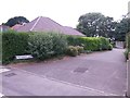
Kinson: Weymans Drive and footpath E36
Weymans Drive is a tiny stub of road off Weymans Avenue, comprising only two properties, no.1 just to our right and no.2 behind it. It is part of public footpath E38 (the footpath sign is visible, almost hidden in the hedge) which leads into Image
See Image for a picture of the path as it turns the bend in the background.
Image: © Chris Downer
Taken: 14 Jun 2016
0.06 miles
5
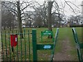
Kinson, Pelhams Park
Green Flag park in Kinson, with various sporting activities & Pelhams House Image (to the right, in the distance). For more information, see http://www.bournemouth.gov.uk/Visitors/Parks_Gardens_Countryside/pelhams_park/default.asp
Image: © Mike Faherty
Taken: 28 Feb 2009
0.07 miles
6
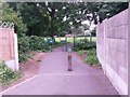
Kinson: footpath E36 enters Pelhams Park
Image: © Chris Downer
Taken: 14 Jun 2016
0.07 miles
7
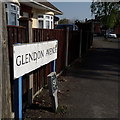
Kinson: Glendon Avenue
The bungalows on the left and the houses on the right are all quite desirable properties, typifying this part of Kinson north of Wimborne Road.
The sign is of a design that became prevalent in Bournemouth around 1990 and was in use for most of that decade. Many are starting to look a bit shabby now, and the blue border has faded almost to nothing on this one, with the white surface peeled off around the edges.
This is photo no.162 of a series of 453 in my coronavirus lockdown walking project:
See https://www.geograph.org.uk/article/My-2020-Coronavirus-Lockdown-walking-project for the complete set of photos.
Image: © Chris Downer
Taken: 10 Apr 2020
0.10 miles
8
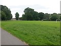
Kinson: playing field at Pelhams Park
Pelhams Park is a large, municipal recreation centre comprising a leisure centre behind us, and large grounds including the football field seen here, along with a playpark in the distance. The building far left is a community health centre.
Image: © Chris Downer
Taken: 14 Jun 2016
0.10 miles
9
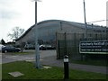
Kinson, health club
Club house with dramatic sweeping roof. For more information, see http://www.roko.co.uk/bournemouth/index.html
Image: © Mike Faherty
Taken: 28 Feb 2009
0.13 miles
10
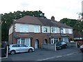
Kinson: 11a, 11 and 13 Weymans Avenue
What appears to be a row of three mid-1900s houses is not quite what it seems. The unnatural numbering hints at the fact that the left-hand property, 11a, was not built at the same time. In fact, it was built in 2013 on what had been a vacant plot.
The external appearance has been made very convincing, although I was talking to the man who lives here and he said it is noticeably modern inside, in having hollow walls which do not insulate against noise between rooms. I'm sure that's not the case with the other two.
See also Image
Image: © Chris Downer
Taken: 24 Jun 2016
0.14 miles