
IMAGES TAKEN NEAR TO
Wimborne Road, BOURNEMOUTH, BH10 7BT
Introduction
This page details the photographs taken nearby to Wimborne Road, BH10 7BT by members of the Geograph project.
The Geograph project started in 2005 with the aim of publishing, organising and preserving representative images for every square kilometre of Great Britain, Ireland and the Isle of Man.

There are currently over 7.5m images from over14,400 individuals and you can help contribute to the project by visiting https://www.geograph.org.uk
Image Map
Images are licensed for reuse under creativecommons.org/licenses/by-sa/2.0
Notes
- Clicking on the map will re-center to the selected point.
- The higher the marker number, the further away the image location is from the centre of the postcode.
Image Listing (124 Images Found)
Images are licensed for reuse under creativecommons.org/licenses/by-sa/2.0
Image
Details
Distance
1
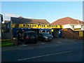
Northbourne: Kinson Tyre Service
Looking across the main Wimborne Road to this tyre service centre, at no.1469 Wimborne Road, which was established in 1966.
There is no official boundary between Kinson and Northbourne, but Kinson is really a little bit west of here.
Image: © Chris Downer
Taken: 6 Oct 2016
0.03 miles
2
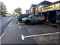
Northbourne: my car is jacked up
After coincidentally receiving nails in two tyres, my car is jacked up on the forecourt of Image and awaits roadworthiness.
In the distance is Image
Image: © Chris Downer
Taken: 6 Oct 2016
0.03 miles
3
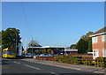
Car Dealer on the Wimborne Road
This car dealership is located on a site that was formerly a petrol station. It is close to the junction with Ashridge Avenue.
Image: © Nigel Mykura
Taken: 15 Nov 2011
0.03 miles
4
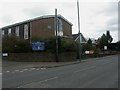
Kinson Methodist Church
As the sign says in smaller print, actually in Northbourne. Doesn't seem to have a web presence, but according to the sign as well as services, there are groups for healing, women, wives, parents & toddlers, & guides.
Image: © Mike Faherty
Taken: 28 Feb 2009
0.04 miles
5
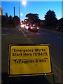
Northbourne: overrunning roadworks on Wimborne Road
Emergency gas main works began here on 11 April, for around three weeks according to the sign but, today, they are even overrunning the suggested 10 weeks written by some wag below the original figure. This is just one of numerous gas-related works that have required traffic lights or even road closures around Bournemouth in the last few months.
The temporary traffic lights are a particular nuisance on this busy route because there is a signal-controlled junction in close proximity beyond.
Image: © Chris Downer
Taken: 29 Jun 2011
0.04 miles
6
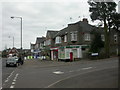
Northbourne, closed post office
Forlorn-looking closed post office in Northbourne, at the junction of Wimborne Road & Ashridge Avenue; closed 29th Oct 2008. For a list of closures in Dorset, see http://www.westbournemouthukip.com/docs/Dorset%20Post%20Office%20closures.pdf
Image: © Mike Faherty
Taken: 28 Feb 2009
0.05 miles
7
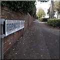
Northbourne: Ferncroft Road
Looking up this smart tree-lined roads from Wimborne Road. It forms a kind of three-pronged fork layout with neighbouring Ashridge Avenue and Pinecliffe Avenue, with Hogue Avenue joining the three of them at the top end.
I'm therefore not sure why this one should be named Ferncroft Road rather than Ferncroft Avenue, but there it is.
The sign is the standard Bournemouth nameplate from the 1980s, affixed with tubular steel which protrudes at each side.
This is photo no.141 of a series of 453 in my coronavirus lockdown walking project:
See https://www.geograph.org.uk/article/My-2020-Coronavirus-Lockdown-walking-project for the complete set of photos.
Image: © Chris Downer
Taken: 13 Apr 2020
0.05 miles
8

Northbourne: footpath E45 reaches Vernalls Close
This short public footpath from Wimborne Road arrives at the dead end of Vernalls Close, with Vernalls Gardens off to the right.
See Image for the view up the path from ahead, and Image for the other end of the path, behind us.
Image: © Chris Downer
Taken: 10 Jul 2016
0.05 miles
9

Northbourne: footpath E45 heads off from Vernalls Close
A late evening view along the dead end of Vernalls Close, with Vernalls Gardens to the left. This left-hand pavement continues as a public footpath to Wimborne Road.
See Image for the view onto the road from the path.
Image: © Chris Downer
Taken: 10 Jul 2016
0.05 miles
10

Northbourne: footpath E45 to Vernalls Close
The footpath runs alongside modern flats at 1471-1479 Wimborne Road, previously a vacant grass plot if I recall correctly.
See Image for the path's emergence at the other end.
Image: © Chris Downer
Taken: 10 Jul 2016
0.05 miles