
IMAGES TAKEN NEAR TO
Ross Mount Close, BOURNEMOUTH, BH10 6BA
Introduction
This page details the photographs taken nearby to Ross Mount Close, BH10 6BA by members of the Geograph project.
The Geograph project started in 2005 with the aim of publishing, organising and preserving representative images for every square kilometre of Great Britain, Ireland and the Isle of Man.

There are currently over 7.5m images from over14,400 individuals and you can help contribute to the project by visiting https://www.geograph.org.uk
Image Map
Images are licensed for reuse under creativecommons.org/licenses/by-sa/2.0
Notes
- Clicking on the map will re-center to the selected point.
- The higher the marker number, the further away the image location is from the centre of the postcode.
Image Listing (100 Images Found)
Images are licensed for reuse under creativecommons.org/licenses/by-sa/2.0
Image
Details
Distance
1
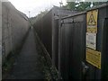
Redhill: danger of death on footpath O13
The casual user of this public footpath will not experience any danger, of course - the sign is on the gates of an electricity substation halfway along the path.
See Image for the view down the path from Redhill Drive, ahead, and Image for the view behind us (just round a slight bend) towards Pine Vale Crescent.
Image: © Chris Downer
Taken: 6 Jul 2016
0.01 miles
2
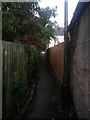
Redhill: footpath O13 heads for Pine Vale Crescent
Pine Vale Crescent is a long crescent with perhaps 300m between its two junctions with Redhill Drive. This public footpath therefore forms a useful cut-through roughly halfway between them.
See Image for the view along the path from the road ahead, and Image for the view behind us (just round a slight bend) towards Redhill Drive.
Image: © Chris Downer
Taken: 6 Jul 2016
0.02 miles
3
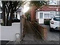
Redhill: footpath O13 from Pine Vale Crescent
Pine Vale Crescent is a long crescent with perhaps 300m between its two junctions with Redhill Drive. This public footpath therefore forms a useful cut-through roughly halfway between them.
See Image for a view towards us from along the path, and links to other photos along the route.
Image: © Chris Downer
Taken: 6 Jul 2016
0.03 miles
4
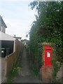
Redhill: footpath O13 to Pine Vale Crescent
Pine Vale Crescent is a long crescent with perhaps 300m between its two junctions with Redhill Drive. This public footpath therefore forms a useful cut-through roughly halfway between them.
See Image for the next view along the path.
Alongside the path is Image
Image: © Chris Downer
Taken: 6 Jul 2016
0.04 miles
5
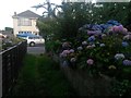
Redhill: hydrangeas alongside footpath O08
This public footpath reaches Redhill Drive and passes colourful hydrangea flowers on this uncolourful evening.
See Image for the view down the path from the end ahead, and Image for the next view behind us with further links to photos all along the route.
Image: © Chris Downer
Taken: 6 Jul 2016
0.05 miles
6
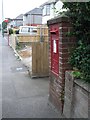
Redhill: postbox № BH10 184, Redhill Drive
A George V-reign box set into a brick pillar in Redhill Drive. Immediately alongside is a footpath to Pine Vale Crescent.
Image: © Chris Downer
Taken: 6 Jul 2008
0.05 miles
7
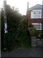
Redhill: footpath O08 from Redhill Drive
This path passes between two houses and then enters woodland before dropping steeply down to Sandy Way.
See Image for the view out of the path from ahead, along with further links to photos along the full length of the footpath.
Image: © Chris Downer
Taken: 6 Jul 2016
0.05 miles
8
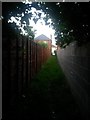
Redhill: footpath O08 approaches daylight and Redhill Drive
This public footpath has come up from the wooded area around Sandy Way, and here emerges from thick cover of trees just before it arrives on Redhill Drive.
See Image for the next picture ahead, and Image for the next view behind us, along with further links to photos along the route.
Image: © Chris Downer
Taken: 6 Jul 2016
0.06 miles
9
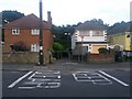
Redhill: footpath O05 to Redhill Common
There is a requirement to keep the entrance to this public footpath clear of parked cars. It is a short public right of way, leading to Redhill Common behind the houses, but the path continues down to Redhill Avenue and across it via footbridge: see Image for the other end of the path.
Image: © Chris Downer
Taken: 6 Jul 2016
0.08 miles
10
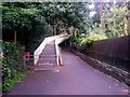
Redhill: footpath O05 reaches the footbridge
A view of the other end of Image which has arrived here from Pine Vale Crescent, behind us. The public right of way extends to the end of the garden wall on the right, but access to the common is unhindered, by way of the continuing path to this wooded side of the common, or via the footbridge to the more park-like eastern side.
See Image for a view of the footbridge from the other end.
Image: © Chris Downer
Taken: 6 Jul 2016
0.09 miles