
IMAGES TAKEN NEAR TO
Frensham Close, BOURNEMOUTH, BH10 6AR
Introduction
This page details the photographs taken nearby to Frensham Close, BH10 6AR by members of the Geograph project.
The Geograph project started in 2005 with the aim of publishing, organising and preserving representative images for every square kilometre of Great Britain, Ireland and the Isle of Man.

There are currently over 7.5m images from over14,400 individuals and you can help contribute to the project by visiting https://www.geograph.org.uk
Image Map
Images are licensed for reuse under creativecommons.org/licenses/by-sa/2.0
Notes
- Clicking on the map will re-center to the selected point.
- The higher the marker number, the further away the image location is from the centre of the postcode.
Image Listing (87 Images Found)
Images are licensed for reuse under creativecommons.org/licenses/by-sa/2.0
Image
Details
Distance
1
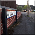
Northbourne: Frensham Close
A short cul-de-sac of bungalows off the southern end of Pine Vale Crescent, the end bungalows backing onto Redhill Common but with no public access to it from here.
The sign is a modern one, dating from around 2014-15, by which time the council had replaced the coloured logo, which had been prone to fading after a while, to simple wording BOURNEMOUTH BOROUGH COUNCIL in smaller type.
This is photo no.150 of a series of 453 in my coronavirus lockdown walking project:
See https://www.geograph.org.uk/article/My-2020-Coronavirus-Lockdown-walking-project for the complete set of photos.
Image: © Chris Downer
Taken: 12 Apr 2020
0.03 miles
2
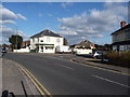
Bournemouth : Redhill Drive
A junction with Pine Vale Crescent and the convenience store can be seen here.
Image: © Lewis Clarke
Taken: 11 Feb 2010
0.04 miles
3
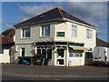
Bournemouth : Redhill News Convenience Stores
Daily Echo have the headline : "Head boy excluded for a kiss"
Image: © Lewis Clarke
Taken: 11 Feb 2010
0.06 miles
4
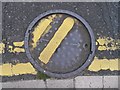
Redhill: errant drain cover in Redhill Drive
Whenever I drive along here I always want to reset this manhole cover so that the yellow lines are in the correct position.
The cover is inscribed with the words "County Borough of Bournemouth" which has not been in official existence since 1974 when Bournemouth was transferred to Dorset. It may be even longer ago that the local council rather than the water board had responsibility for sewers and suchlike below the road.
Image: © Chris Downer
Taken: 23 Oct 2016
0.06 miles
5
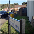
Redhill: Coppice View
A fairly recent development - perhaps around 2000, if memory serves, of private semi-detached housing, coming off Redhill Drive and backing onto the vast Redhill Park.
The sign is a modern one, from 2010-15 when this more modern, abstract emblem rather than the traditional town coat of arms as the working logo of the council. It features a no-through road sign, a common arrangement.
This is photo no.86 of a series of 453 in my coronavirus lockdown walking project:
See https://www.geograph.org.uk/article/My-2020-Coronavirus-Lockdown-walking-project for the complete set of photos.
Image: © Chris Downer
Taken: 13 Apr 2020
0.08 miles
6
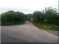
Redhill: Sandy Way from Headswell Avenue
Sandy Way is a lane some 630m in length which forms public bridleway O07 between Wimborne Road and Headswell Avenue. At each end, it is a gravel road with a few dwellings but the majority of it is a very rural feeling track in a steep sided, linear wood.
Here, we look along Sandy Way from its southern end.
See Image for the next view along the route, giving links to further photos all along the route.
Image: © Chris Downer
Taken: 6 Jul 2016
0.08 miles
7
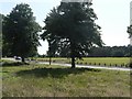
Redhill: playing field and Redhill Avenue
Looking across Redhill Avenue towards the vast playing field of Redhill Park.
See also Image
Image: © Chris Downer
Taken: 22 Jun 2008
0.09 miles
8
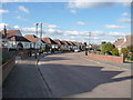
Bournemouth : Headswell Avenue
Bungalows line the avenue here in Bournemouth.
Image: © Lewis Clarke
Taken: 11 Feb 2010
0.09 miles
9
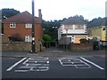
Redhill: footpath O05 to Redhill Common
There is a requirement to keep the entrance to this public footpath clear of parked cars. It is a short public right of way, leading to Redhill Common behind the houses, but the path continues down to Redhill Avenue and across it via footbridge: see Image for the other end of the path.
Image: © Chris Downer
Taken: 6 Jul 2016
0.09 miles
10
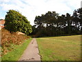
Redhill: path into the woods at Redhill Common
The large Redhill Common comprises three distinct parts this side of the main road - a general area of grass here, the linear woods in the background, and beyond them the large area of sports pitches.
Image: © Chris Downer
Taken: 23 Oct 2010
0.09 miles