
IMAGES TAKEN NEAR TO
Ibbett Road, BOURNEMOUTH, BH10 5HP
Introduction
This page details the photographs taken nearby to Ibbett Road, BH10 5HP by members of the Geograph project.
The Geograph project started in 2005 with the aim of publishing, organising and preserving representative images for every square kilometre of Great Britain, Ireland and the Isle of Man.

There are currently over 7.5m images from over14,400 individuals and you can help contribute to the project by visiting https://www.geograph.org.uk
Image Map
Images are licensed for reuse under creativecommons.org/licenses/by-sa/2.0
Notes
- Clicking on the map will re-center to the selected point.
- The higher the marker number, the further away the image location is from the centre of the postcode.
Image Listing (91 Images Found)
Images are licensed for reuse under creativecommons.org/licenses/by-sa/2.0
Image
Details
Distance
1
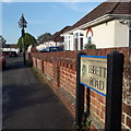
East Howe: Ibbett Road
Ibbett Road forms part of a small layout of roads to the north of Kingswell Road, ending at Hadow Road which contains the local schools, Kingsleigh Primary and The Bourne Academy (previously Kingsleigh Secondary). Hadow and Ibbett are named after men who were part of the Borough's Education Committee around the time that the schools were built in the 1950s (and I suspect Bennion may have been too, as this is the name of the road which links the two).
The road sign is a standard one from around 2000, featuring the borough coat of arms, and one of the earliest of these given the emboldened typeface – most have a less harsh typeface and a background less prone to discoloration.
This is photo no.212 of a series of 453 in my coronavirus lockdown walking project:
See https://www.geograph.org.uk/article/My-2020-Coronavirus-Lockdown-walking-project for the complete set of photos.
Image: © Chris Downer
Taken: 20 Apr 2020
0.03 miles
2
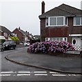
Ensbury Park: Kingswell Gardens
One of three offshoots of Kingswell Road that share its first name, Close and Grove being the other two.
The sign is the standard Bournemouth nameplate from the 1980s, affixed with tubular steel which protrudes at each side. It is surprising that a no-through-road sign is not either incorporated into the sign or standing alongside it, both of which are common arrangements.
This is photo no.226 of a series of 453 in my coronavirus lockdown walking project:
See https://www.geograph.org.uk/article/My-2020-Coronavirus-Lockdown-walking-project for the complete set of photos.
Image: © Chris Downer
Taken: 11 Apr 2020
0.06 miles
3
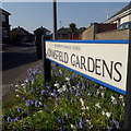
Ensbury Park: Adamsfield Gardens
A reasonably modern infill road off Kingswell Road, probably 1980s judging by the predecessor name sign on Google Street View. This sign is a very modern one and stands in a patch of snowdrops and bluebells.
This is photo no.5 of a series of 451 in my coronavirus lockdown walking project:
See https://www.geograph.org.uk/article/My-2020-Coronavirus-Lockdown-walking-project for the complete set of photos.
Image: © Chris Downer
Taken: 11 Apr 2020
0.06 miles
4
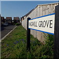
Ensbury Park: Kingswell Grove
One of three offshoots of Kingswell Road that share its first name, Gardens and Close being the other two.
The sign is a modern one - it is only in the last couple of years that Bournemouth Borough Council stopped including its name in smaller type at the top of the sign, perhaps in readiness for local government reorganisation in April 2019 which saw the borough council replaced by BCP (Bournemouth, Christchurch & Poole) council.
This is photo no.227 of a series of 453 in my coronavirus lockdown walking project:
See https://www.geograph.org.uk/article/My-2020-Coronavirus-Lockdown-walking-project for the complete set of photos.
Image: © Chris Downer
Taken: 11 Apr 2020
0.08 miles
5
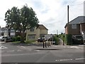
East Howe: looking across Kingswell Road to footpath U33
This public footpath heads south from Kingswell Road, crossing Heaton Road in the process.
Granville Road comes out diagonally here onto Kingswell Road.
See Image for a closer view along the path, and Image for the next view along the path, with discussion on changes to Heaton Road at that point and further links to photos along the route.
Image: © Chris Downer
Taken: 9 Jul 2016
0.08 miles
6
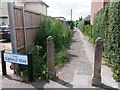
East Howe: footpath U33 to Heaton and Columbia Roads
This public footpath heads south from Kingswell Road, crossing Heaton Road in the process.
Granville Road comes out diagonally here onto Kingswell Road, hence the sign, left.
See Image for the next view along the path, with discussion on changes to Heaton Road at that point and further links to photos along the route.
A wider view of this end of the path, from across the road behind us, is here: Image
Image: © Chris Downer
Taken: 9 Jul 2016
0.08 miles
7
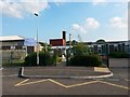
East Howe: Kingsleigh Primary School
Hadow Road provides education right through from nursery to sixth form, with The Bourne Academy (secondary school) behind us, and Kingsleigh Primary School here, including pre-school.
Originally this was Kingsleigh Junior, with Kingsleigh First next to the secondary school, then called Kingsleigh Secondary. The first school site was demolished around the time that it merged with the juniors to form an all-through primary school, in the early 2000s.
Kingsleigh Primary has undergone vast expansion in the last few years, increasing its intake to 120 (four classes) as part of the provision of extra school places - thanks to a large birth-rate increase across Bournemouth. Part of the new-build is seen in the left-hand half of the picture.
The youth centre, just across Kinson Road a few hundred yards from here, is dated 1911 in the gable and was the original East Howe School, the predecessor of the Kingsleighs.
Image: © Chris Downer
Taken: 7 Jun 2016
0.09 miles
8
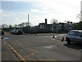
East Howe, primary school
Kingsleigh Primary School & Nursery, on Hadow Road. See also Image http://www.goldhilleducation.com/calendar/jsp/indexpages/kingsleighindex.jsp?schoolName=Kingsleigh
Image: © Mike Faherty
Taken: 1 Mar 2010
0.09 miles
9
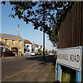
Ensbury Park: Kingswell Road
One of the more major minor roads in this area, if that's not a contradiction, Kingswell Road runs parallel with the main Columbia Road and is therefore relatively busy, feeding local side roads to the more major network. It is about ¾ mile in length and we see it here from its only substantial bend, about 10º or so.
The housing is varied but not much of it is as old as the cottage we see on the far left, which was the original farmhouse whose farmland was used for the development of this whole area from the 1930s.
The sign is of a design that became prevalent in Bournemouth around 1990 and was in use for most of that decade. Many are starting to look a bit shabby now, with the blue border fading and the white surface peeling, but this one is in pretty good nick.
This is photo no.228 of a series of 453 in my coronavirus lockdown walking project:
See https://www.geograph.org.uk/article/My-2020-Coronavirus-Lockdown-walking-project for the complete set of photos.
Image: © Chris Downer
Taken: 19 Apr 2020
0.09 miles
10
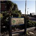
East Howe: Bennion Road
Bennion Road is part of a small area of council housing at this northern end, coming out onto Hadow Road. Beyond the left bend in the background, the bungalows more prevalent in Ensbury Park take over. Hadow Road, on which we stand, leads to the local primary and secondary schools and is named after a Borough councillor who planned for the town's schooling following the Education Act 1944 – I believe Bennion Road may be named after a colleague of his.
The patch of garden behind this sign is outside the fence of the domestic garden, but within the area that would normally be associated with the household. It is thus not clear whether it is maintained municipally or by the householder.
The road sign is a standard one from around 2000-2006, perhaps a little earlier, featuring the borough coat of arms.
This is photo no.34 of a series of 451 in my coronavirus lockdown walking project:
See https://www.geograph.org.uk/article/My-2020-Coronavirus-Lockdown-walking-project for the complete set of photos.
Image: © Chris Downer
Taken: 14 Apr 2020
0.09 miles