
IMAGES TAKEN NEAR TO
Coombe Avenue, BOURNEMOUTH, BH10 5AB
Introduction
This page details the photographs taken nearby to Coombe Avenue, BH10 5AB by members of the Geograph project.
The Geograph project started in 2005 with the aim of publishing, organising and preserving representative images for every square kilometre of Great Britain, Ireland and the Isle of Man.

There are currently over 7.5m images from over14,400 individuals and you can help contribute to the project by visiting https://www.geograph.org.uk
Image Map
Images are licensed for reuse under creativecommons.org/licenses/by-sa/2.0
Notes
- Clicking on the map will re-center to the selected point.
- The higher the marker number, the further away the image location is from the centre of the postcode.
Image Listing (92 Images Found)
Images are licensed for reuse under creativecommons.org/licenses/by-sa/2.0
Image
Details
Distance
1
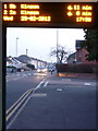
Northbourne: Coombe Avenue becomes Leybourne Avenue
Looking south from under a bus shelter in Leybourne Avenue, across the junction where it becomes Coombe Avenue as Hill View Road crosses in both directions. The bus shelter has a display giving the date (29 February) and current time, and details of the next due arrivals. I don't know why the first one is apparently due in 11 minutes but the second one in only six. The date/time display intermittently changes to show the third expected arrival.
Image: © Chris Downer
Taken: 29 Feb 2012
0.06 miles
2
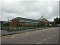
Ensbury Park, Hill View Primary School
On Hill View Road. The original school buildings are at the front, and newer ones at the back (seen to the left). http://www.hillview.bournemouth.sch.uk/introduction/the_school.htm
Image: © Mike Faherty
Taken: 26 Jul 2009
0.07 miles
3
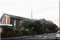
Ensbury Park: parish church of St. Thomas
This church is right in the southwest corner of the square – so much so that the intersection of the four squares coincides with the road junction whose corner the church stands.
Image: © Chris Downer
Taken: 4 Jul 2007
0.07 miles
4
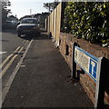
Redhill: Delamere Gardens
A short dead-end road off Redhill Drive, facing onto Redhill Park which is behind us, across the road. Beyond the back gardens of the houses each side, we can glimpse the desirable detached housing of Delamere Gardens, typical of the area.
The road sign is a standard one from around 2000-2006, perhaps a little earlier, featuring the borough coat of arms. The incorporated no-through-road sign is a common arrangement, and for good measure the message is reinforced with the word CUL-DE-SAC in small type at the bottom.
This is photo no.106 of a series of 453 in my coronavirus lockdown walking project:
See https://www.geograph.org.uk/article/My-2020-Coronavirus-Lockdown-walking-project for the complete set of photos.
Image: © Chris Downer
Taken: 13 Apr 2020
0.07 miles
5
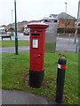
Northbourne: postbox № BH10 223, Hill View Road
This George V-reign postbox faces the entrance to Image on the corner of Hill View Road and Leybourne Avenue. Behind it is a doorless phone box, facing the other way.
Image: © Chris Downer
Taken: 5 Jan 2013
0.08 miles
6
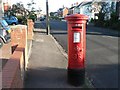
Ensbury Park: postbox № BH10 152, Western Avenue
Situated on Western Avenue, opposite the Doveshill Crescent turning.
Image: © Chris Downer
Taken: 3 Jul 2008
0.08 miles
7
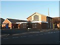
Ensbury Park: parish church of St. Thomas, and hall
A similar view to Image, looking a few degrees farther round towards the north and showing the hall attached to the northern end of the church. The foliage in front of the church has very recently had a severe pruning!
Image: © Chris Downer
Taken: 22 Aug 2008
0.08 miles
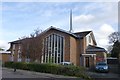
9
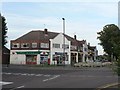
Redhill: New Parade
A parade of shops in Hill View Road, including post office, bakery, grocery and hairdresser.
Image: © Chris Downer
Taken: 21 Jul 2008
0.09 miles
10
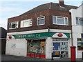
Redhill: Redhill Drive Post Office
This post office is in Image, in Hill View Road by the corner with Leybourne Avenue – and yet it is called Redhill Drive. That is because it moved here in the late 1990s from the eastern end of Hill View Road, indeed on the corner of Redhill Drive.
Image: © Chris Downer
Taken: 21 Jul 2008
0.09 miles